Valframbert | |
|---|---|
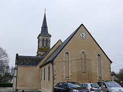 The church in Valframbert | |
 Location of Valframbert | |
Valframbert Valframbert | |
| Coordinates: 48°27′52″N 0°06′32″E / 48.4644°N 0.1089°E / 48.4644; 0.1089 | |
| Country | France |
| Region | Normandy |
| Department | Orne |
| Arrondissement | Alençon |
| Canton | Damigny |
| Intercommunality | CU d'Alençon |
| Government | |
| • Mayor (2020–2026) | Francis Aïvar1 |
Area 1 | 13.95 km2 (5.39 sq mi) |
| Population (2023)2 | 1,678 |
| • Density | 120.3/km2 (311.5/sq mi) |
| Time zone | UTC+01:00 (CET) |
| • Summer (DST) | UTC+02:00 (CEST) |
| INSEE/Postal code | 61497 /61250 |
| Elevation | 133–179 m (436–587 ft) (avg. 147 m or 482 ft) |
| 1 French Land Register data, which excludes lakes, ponds, glaciers > 1 km2 (0.386 sq mi or 247 acres) and river estuaries. | |
Valframbert (French pronunciation: [valfʁɑ̃bɛʁ] ⓘ) is a commune in the Orne department in north-western France.
Geography
The commune is made up of the following collection of villages and hamlets, Vaucelle, Chemoitou, La Dormie, Congé, Valframbert and Les Grouas.3
The commune along with another 32 communes is part of a 3,503 hectare, Natura 2000 conservation area, called the Haute vallée de la Sarthe.4
The river Sarthe is the sole watercourse that flows through the commune.5
Points of interest
National heritage sites
- Château d'Aché a nineteenth century chateau, it was registered as a Monument historique in 1994.6
Transport
- Aérodrome d'Alençon - Valframbert is an Aerodrome within the commune which is also shared with neighbouring communes of Cerisé and Alençon that opened in 1936.78 Its IATA airport code is XAN and its ICAO airport code is LFOF.9
- Aire de La Dentelle à Alencon Normandie is a service station on the A28 autoroute.10
References
References
- "Répertoire national des élus: les maires". data.gouv.fr, Plateforme ouverte des données publiques françaises (in French). 2 December 2020.
- "Populations de référence 2023" (in French). National Institute of Statistics and Economic Studies. 18 December 2025.
- "Google Maps". Google Maps.
- "INPN - FSD Natura 2000 - FR2500107 - Haute Vallée de la Sarthe - Description". Archived from the original on 31 July 2024. Retrieved 31 August 2024.
- Sandre. "Fiche cours d'eau - Sarthe (M---0060)".
- "Château d'Aché à Valframbert - PA00132906". monumentum.fr.
- "Histoire. Alençon a-t-elle raté le train de l'aviation ?". actu.fr. 1 June 2021.
- "Google Maps". Google Maps.
- "Alençon Valframbert - France". World Airport Codes.
- "Aire de la Dentelle d'Alençon : une halte très appréciée sur la route des 24 Heures Motos du Mans". actu.fr. 17 April 2026.