| Valamara | |
|---|---|
| Mali i Valamarës | |
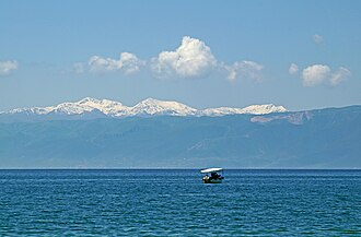 View of the massif seen from Lake Ohrid | |
| Highest point | |
| Elevation | 2,373 m (7,785 ft) |
| Prominence | 1,525 m (5,003 ft)12 |
| Isolation | 26.5 km (16.5 mi) |
| Listing | Ultra, Ribu |
| Coordinates | 40°47′36″N 20°27′53″E / 40.793338°N 20.464752°E / 40.793338; 20.464752 |
| Geography | |
Valamara | |
Country | |
Region | Central Mountain Region |
Municipality | Korçë, Gramsh, Pogradec |
| Parent range | Shpat–Polis–Lenie |
| Geology | |
| massif | |
| Rock type | ultrabasic rock |
Valamara is a massif located in eastern Albania. Converging on the borders between Korçë, Gramsh and Pogradec municipalities, it rises at a height of 2,373 m (7,785 ft). The northern boundary is marked by Guri i Topit (2,125 m) and the southern limit by Lenie (2,013 m).3
Geology
The massif is predominantly composed of ultrabasic rocks. Its terrain features various glacial landforms with numerous glacial lakes, seven of which can be found above 1,600 m (5,200 ft).4 The eastern slopes give rise to the Shkumbin river, while the western and southeastern slopes are traversed by the Devoll river.
Biodiversity
Valamara is a population hotspot for the critically endangered Balkan lynx.5
Vegetation consists of beech and pine forests covering the lower regions and rich summer pastures flourishing in the upper regions.6
References
References
- Bjørstad, Petter. "Europe Ultra–Prominences". Peaklist. Retrieved 28 October 2013.
- Quinn, Daniel. "List of prominent peaks in the Balkans". World Ribus. Retrieved 6 December 2025.
- Qiriazi, Perikli (1985). Fjalori Enciklopedik Shqiptar. Tiranë: Akademia e Shkencave e RPSSH. p. 1150.
- "Pamje befasuese me dron nga Mali i Valamarës". Euronews Albania. Retrieved 31 May 2020.
- Soreghan, Emily. "Can Lynx Be Saved in the Balkans?". Smithsonian Magazine. Retrieved 2025-01-06.
- "The vascular flora of the Valamara mountain range (SE Albania), with three new records for the Albanian flora" (PDF). researchgate.net. pp. 1–17.