Kall | |
|---|---|
 | |
 Flag  Coat of arms | |
Location of Kall
within Euskirchen district | |
 Location of Kall | |
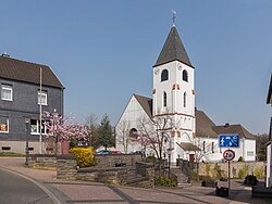
Kall Kall | |
| Coordinates: 50°33′N 06°33′E / 50.550°N 6.550°E / 50.550; 6.550 | |
| Country | Germany |
| State | North Rhine-Westphalia |
| Admin. region | Köln |
| District | Euskirchen |
| Government | |
| • Mayor (2025–30) | Emmanuel Kunz1 (SPD) |
| Area | |
• Total | 66.07 km2 (25.51 sq mi) |
| Elevation | 399 m (1,309 ft) |
| Population (2024-12-31)2 | |
• Total | 11,180 |
| • Density | 169.2/km2 (438.3/sq mi) |
| Time zone | UTC+01:00 (CET) |
| • Summer (DST) | UTC+02:00 (CEST) |
| Postal codes | 53925 |
| Dialling codes | 02441, 02445, 02447, 02482, 02486 |
| Vehicle registration | EU |
| Website | www.kall.de |

Kall (German pronunciation: [kal]) is a municipality in the district of Euskirchen in the state of North Rhine-Westphalia, Germany. It is located in the Eifel hills, approximatively 20 km south-west of Euskirchen.
Kall consists of the following districts: Anstois, Benenberg, Diefenbach, Dottel, Frohnrath, Gillenberg, Golbach, Keldenich, Krekel, Rinnen, Roder, Rüth, Scheven, Sistig, Sötenich, Steinfeld, Steinfelderheistert, Straßbüsch, Urft, Wahlen, Wallenthal, Wallenthalerhöhe, and Kall itself.3
Most important river within Kall is the Urft, a tributary to the Roer. Parts of Kall belong to Eifel National Park.
Kall had been affected by 2021 European floods. Three persons died4, also rail installations and residential buildings had been damaged.
References
References
- https://emmanuel-kunz.de/
- "Bevölkerung der Gemeinden Nordrhein-Westfalens am 31. Dezember 2024 – Fortschreibung des Bevölkerungsstandes auf Basis des Zensus 2022" (in German). Landesbetrieb Information und Technik NRW.
- "Zahlen und Daten / Bevölkerung" (in German). Gemeinde Kall. Archived from the original on 27 February 2014. Retrieved 31 January 2017.
- https://www.kall.de/aktuelles/ein-wuerdevolles-gedenken.php