| Parapeiros | |
|---|---|
 | |
 | |
| Native name | Παραπείρος (Greek) |
| Location | |
| Country | Greece |
| Region | Achaea |
| Physical characteristics | |
| Source | |
| • location | Mount Erymanthos |
| Mouth | |
• location | Peiros |
• coordinates | 38°7′34″N 21°38′30″E / 38.12611°N 21.64167°E / 38.12611; 21.64167 |
| Length | 28.5 km (17.7 mi) |
| Basin features | |
| Progression | Peiros→ Ionian Sea |

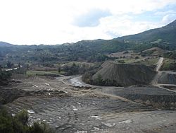
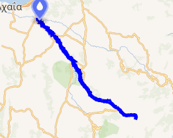
The Parapeiros (Greek: Παραπείρος, also Τυθεύς - Tythefs, Ancient Greek: Τευθέας - Teutheas1) is a river in the western part of Achaea, Greece. It is 28.5 km (17.7 mi) long.2 The Parapeiros begins in the western part of the Erymanthos mountains close to Alepochori. It passes through the municipal units of Tritaia and Farres. It empties into the river Peiros near the village Agios Stefanos.
References
References
- Smith, William, ed. (1854). "Achaia". Dictionary of Greek and Roman Geography. Vol. 1. London: John Murray. p. 14.
- "Preliminary Flood Risk Assessment" (in Greek). Ministry of Environment, Energy and Climate Change. p. 42. Archived from the original on 15 February 2020.