Trélon | |
|---|---|
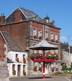 The town hall in Trélon | |
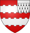 Coat of arms | |
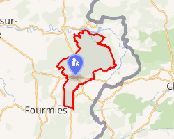 Location of Trélon | |
Trélon Trélon | |
| Coordinates: 50°03′32″N 4°06′12″E / 50.0589°N 4.1033°E / 50.0589; 4.1033 | |
| Country | France |
| Region | Hauts-de-France |
| Department | Nord |
| Arrondissement | Avesnes-sur-Helpe |
| Canton | Fourmies |
| Intercommunality | CC Sud Avesnois |
| Government | |
| • Mayor (2020–2026) | Thierry Reghem1 |
Area 1 | 39.15 km2 (15.12 sq mi) |
| Population (2023)2 | 2,604 |
| • Density | 66.51/km2 (172.3/sq mi) |
| Time zone | UTC+01:00 (CET) |
| • Summer (DST) | UTC+02:00 (CEST) |
| INSEE/Postal code | 59601 /59132 |
| Elevation | 170–251 m (558–823 ft) (avg. 250 m or 820 ft) |
| 1 French Land Register data, which excludes lakes, ponds, glaciers > 1 km2 (0.386 sq mi or 247 acres) and river estuaries. | |
Trélon (French pronunciation: [tʁelɔ̃]) is a commune in the Nord department in northern France.3
Trélon forms the western edge of the Calestienne region.
Population
| Year | Pop. | ±% p.a. |
|---|---|---|
| 1968 | 3,214 | — |
| 1975 | 3,438 | +0.97% |
| 1982 | 3,166 | −1.17% |
| 1990 | 2,923 | −0.99% |
| 1999 | 2,828 | −0.37% |
| 2007 | 2,984 | +0.67% |
| 2012 | 2,974 | −0.07% |
| 2017 | 2,856 | −0.81% |
| 2023 | 2,604 | −1.53% |
| Source: INSEE4 | ||
Heraldry
|
The arms of Trélon are blazoned : Gules, 2 fesses embattled counter-embattled argent, overall a sinister canton ermine with a chief argent.
|
References
References
- "Répertoire national des élus: les maires" (in French). data.gouv.fr, Plateforme ouverte des données publiques françaises. 13 September 2022.
- "Populations de référence 2023" (in French). National Institute of Statistics and Economic Studies. 18 December 2025.
- INSEE commune file
- Population municipale entre 1968 et 2023, INSEE