Thiant | |
|---|---|
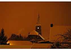 The church in Thiant | |
 Coat of arms | |
 Location of Thiant | |
Thiant Thiant | |
| Coordinates: 50°18′23″N 3°26′57″E / 50.3064°N 3.4492°E / 50.3064; 3.4492 | |
| Country | France |
| Region | Hauts-de-France |
| Department | Nord |
| Arrondissement | Valenciennes |
| Canton | Aulnoy-lez-Valenciennes |
| Intercommunality | CA Porte du Hainaut |
| Government | |
| • Mayor (2022–2026) | Marc Wattiez1 |
Area 1 | 8.39 km2 (3.24 sq mi) |
| Population (2023)2 | 2,914 |
| • Density | 347/km2 (900/sq mi) |
| Time zone | UTC+01:00 (CET) |
| • Summer (DST) | UTC+02:00 (CEST) |
| INSEE/Postal code | 59589 /59224 |
| Elevation | 26–72 m (85–236 ft) (avg. 31 m or 102 ft) |
| 1 French Land Register data, which excludes lakes, ponds, glaciers > 1 km2 (0.386 sq mi or 247 acres) and river estuaries. | |
Thiant (French pronunciation: [tjɑ̃]) is a commune in the Nord department in northern France.3
Population
| Year | Pop. | ±% p.a. |
|---|---|---|
| 1968 | 2,925 | — |
| 1975 | 2,699 | −1.14% |
| 1982 | 2,635 | −0.34% |
| 1990 | 2,593 | −0.20% |
| 1999 | 2,568 | −0.11% |
| 2007 | 2,534 | −0.17% |
| 2012 | 2,619 | +0.66% |
| 2017 | 2,917 | +2.18% |
| 2023 | 2,914 | −0.02% |
| Source: INSEE4 | ||
Heraldry
|
The arms of Thiant are blazoned : Vert, billetty, a lion argent, armed and langued gules. (Thiant and Aubry-du-Hainaut use the same arms.)
|
References
References
- "Répertoire national des élus: les maires" (in French). data.gouv.fr, Plateforme ouverte des données publiques françaises. 6 June 2023.
- "Populations de référence 2023" (in French). National Institute of Statistics and Economic Studies. 18 December 2025.
- INSEE commune file
- Population municipale entre 1968 et 2023, INSEE