| Tapti Tapi | |
|---|---|
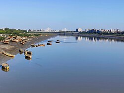 Tapti or Tapi River at Surat. | |
 | |
| Location | |
| Country | India |
| State | Madhya Pradesh, Maharashtra, Gujarat |
| Cities | Multai Nepanagar Burhanpur Bhusawal Mandvi Surat |
| Physical characteristics | |
| Source | Multai, Madhya Pradesh |
| Mouth | Gulf of Khambhat (Arabian Sea) |
• location | Dumas, Surat, Gujarat |
| Length | 724 km (450 mi)approx. |
Basin size | 62,225 km2 (24,025 sq mi) |
| Discharge | |
| • location | Dumas Beach1 |
| • average | 489 m3/s (17,300 cu ft/s) |
| • minimum | 2 m3/s (71 cu ft/s) |
| • maximum | 9,830 m3/s (347,000 cu ft/s) |
| Basin features | |
| Tributaries | |
| • left | Girna, Nesu, Buray, Panjhara, Bori, Waghur, Purna, Mona, Sipna |
| • right | Arunavati, Vaki, Aner, Gomai |
The Tapti River (or Tapi) is a river in central India located south of the Narmada River that flows westward before draining into the Arabian Sea.2 The river is approximately 724 km (450 mi) and flows through the states of Maharashtra, Gujarat and Madhya Pradesh.2 It flows through the city of Surat in Gujarat, and is crossed by several bridges, including the Magdalla, and the ONGC Bridge.3

On 7 August 1968, before the construction of the Ukai Dam to bring its waters under control and provide hydroelectric power, the Tapti River overflowed its banks during heavy rains in the monsoon season. More than 1,000 people drowned in the flood,4 and the city of Surat was submerged beneath 10 feet of water for several days.5 After the floodwaters receded, at least 1,000 more people died in Gujarat during a cholera epidemic from the contamination of the drinking water.6 The Tapti basin covers parts of Madhya Pradesh, Gujarat and Maharashtra.
Course
The Tapti River rises in Multai, in Madhya Pradesh, and with a total length of 724 km7 is the second longest west-flowing river in India, after the Narmada River.8 The Tapti travels east to west and flows through the Indian states of .7 It drains into the Gulf of Khambhat, in the Arabian Sea, in Gujarat.2 The Tapti River has 14 major tributaries, four are right bank and ten are left bank tributaries. The right bank tributaries originate in the Satpura range and include the Vaki, Aner, Arunawati, and Gomai.7 The left bank tributaries include the Nesu, Amravati, Buray, Panjhara, Bori, Girna, Waghur, Purna, Mona, and Sipna. They originate in the Gawilgarh hills, Ajanta hills, the Western Ghats, and Satmalas.7
Etymology
The river is supposedly named after the goddess Tapati, the daughter of Surya, the Sun god and Chhaya. Tapati is the sister of Shani, Bhadra, Yamuna and Yama.9

Surat, Bhusawal, Burhanpur and Multai towns are located near Tapti River.
References
References
- "Tapti Basin Station: Kathore". UNH/GRDC. Retrieved 1 October 2013.
- "Tapti River". Encyclopaedia Britannica. Retrieved 5 April 2021.
- "Truck falls into Tapi River from Magdalla Bridge, driver missing". The Times of India. Bennett, Coleman & Co. 31 May 2016. Retrieved 12 June 2016.
- "1,000 Believed Dead In India Flooding". Pittsburgh Post-Gazette. Associated Press. 13 August 1968. p. 1. Retrieved 24 February 2019.
- "Western India Town Under 10 Feet Of Water; Flood Toll Hits 1,000", Indianapolis Star, 15 August 1968, p2
- Lee Allyn Davis, Facts on File: Natural Disasters (Infobase Publishing, 23 June 2010) pp166-167
- Singh, V.P., ed. (2007). "Hydrology and Water Resources of India". Water Science and Technology Library. 57. Springer: 561–564. doi:10.1007/1-4020-5180-8.
{{cite journal}}: Unknown parameter|Madhya Pradesh, Maharashtra, and Gujaratisbn=ignored (help) - Singh, Dhruv Sen, ed. (2018). The Indian Rivers: Scientific and Socio-economic Aspects. Springer Hydrogeology. Singapore: Springer Singapore. p. 466. doi:10.1007/978-981-10-2984-4. ISBN 978-981-10-2983-7. S2CID 187246753.
- Mittal, J.P. (2006). History of ancient India : a new version. New Delhi: Atlantic. p. 412. ISBN 9788126906161. Retrieved 21 July 2016.