| Surami Pass | |
|---|---|
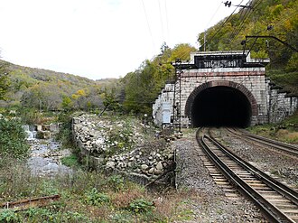 Surami pass railway tunnel at Chkherimela river. | |
| Elevation | 948 m (3,110 ft)1 |
| Range | Likhi Range |
| Coordinates | 42°01′37″N 43°30′01″E / 42.02694°N 43.50028°E / 42.02694; 43.50028 |
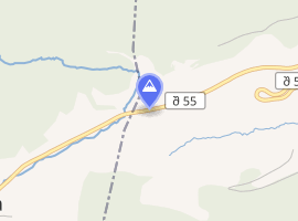 Interactive map of Surami Pass | |
The Surami Pass (Georgian: სურამის უღელტეხილი) is a mountain pass in the Likhi Range of Georgia with an altitude of 949 metres (3,114 ft).
The pass connects the western and eastern part of Georgia. A railroad (in a tunnel) runs through the pass, as well as the Zestaponi–Khashuri highway.
History

A locomotive can be seen on the left source ↗

Rail service through Surami Pass was opened in 1872. The rail line was electrified in 1933.