Storo | |
|---|---|
| Comune di Storo | |
Storo Location of Storo in Italy Show map of ItalyStoro Storo (Trentino-Alto Adige/Südtirol) Show map of Trentino-Alto Adige/Südtirol | |
| Coordinates: 45°51′N 10°35′E / 45.850°N 10.583°E / 45.850; 10.583 | |
| Country | Italy |
| Region | Trentino-Alto Adige/Südtirol |
| Province | Trentino (TN) |
| Frazioni | Darzo, Lodrone, Riccomassimo |
| Government | |
| • Mayor | Nicola Zontini |
| Area | |
• Total | 62.9 km2 (24.3 sq mi) |
| Elevation | 409 m (1,342 ft) |
| Population (Dec. 2004)2 | |
• Total | 4,554 |
| • Density | 72.4/km2 (188/sq mi) |
| Demonym | Storesi |
| Time zone | UTC+1 (CET) |
| • Summer (DST) | UTC+2 (CEST) |
| Postal code | 38089 |
| Dialing code | 0465 |
| Website | Official website |
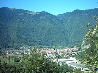
Storo (Stòr in local dialect) is a comune (municipality) in Trentino in the northern Italian region Trentino-Alto Adige/Südtirol, located about 50 kilometres (31 mi) southwest of Trento. As of 31 December 2004, it had a population of 4,554 and an area of 62.9 square kilometres (24.3 mi2).34
The municipality of Storo contains the frazioni (subdivisions, mainly villages and hamlets) Darzo, Lodrone and Riccomassimo.
Storo borders the following municipalities: Condino, Bagolino, Brione, Ledro and Bondone.
Population
Historical population | ||||||||||||||||||||||||||||||||||||||||||||||||||||||||
|
|
| ||||||||||||||||||||||||||||||||||||||||||||||||||||||
 | ||||||||||||||||||||||||||||||||||||||||||||||||||||||||
| Source: Data from ISTAT | ||||||||||||||||||||||||||||||||||||||||||||||||||||||||
References
References
- "Superficie di Comuni Province e Regioni italiane al 9 ottobre 2011". Italian National Institute of Statistics. Retrieved 16 March 2019.
- "Popolazione Residente al 1° Gennaio 2018". Italian National Institute of Statistics. Retrieved 16 March 2019.
- All demographics and other statistics: Italian statistical institute Istat, except 2011 numbers which are approximated based on 2012 information available
- "Italian Communities". Retrieved 7 June 2012.