Åsta | |
|---|---|
Village | |
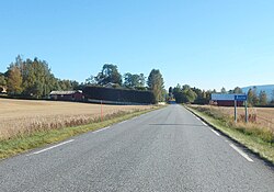 View of the road leading into Åsta | |
 Interactive map of Åsta | |
Åsta Åsta | |
| Coordinates: 61°04′28″N 11°20′54″E / 61.07431°N 11.34843°E / 61.07431; 11.34843 | |
| Country | Norway |
| Region | Eastern Norway |
| County | Innlandet |
| District | Østerdalen |
| Municipality | Åmot Municipality |
| Elevation | 236 m (774 ft) |
| Time zone | UTC+01:00 (CET) |
| • Summer (DST) | UTC+02:00 (CEST) |
| Post Code | 2450 Rena |
Åsta2 is a village in Åmot Municipality in Innlandet county, Norway.
The village is located about 7 kilometres (4.3 mi) south of the village of Rena, the municipal centre. The village of Åsta lies at the confluence of the rivers Åsta and Glomma.3
The Norwegian National Road 3 runs through the village. The Rørosbanen railway line also passes through the village, stopping at Åsta Station.
Åsta was the site of the Åsta accident, which claimed 19 lives.
References
References
- "Åsta, Åmot". yr.no. Retrieved 5 March 2022.
- "Informasjon om stadnamn". Norgeskart (in Norwegian). Kartverket. Retrieved 6 June 2025.
- Thorsnæs, Geir, ed. (26 November 2024). "Åsta (elv)". Store norske leksikon (in Norwegian). Foreningen Store norske leksikon. Retrieved 6 June 2025.