| Spitzingsee | |
|---|---|
 | |
Spitzingsee | |
| Location | Schliersee Mountains, Bavaria |
| Coordinates | 47°39′58″N 11°53′12″E / 47.66611°N 11.88667°E / 47.66611; 11.88667 |
| Lochgraben, Firstgraben | |
| Rote Valepp | |
| Basin countries | Germany |
| Max. length | 950 m (3,120 ft) |
| Max. width | 300 m (980 ft) |
Surface area | 28.3 ha (70 acres) |
Average depth | 7.24 m (23.8 ft) |
| Max. depth | 16.30 m (53.5 ft) |
Water volume | 2,049,000 m3 (72,400,000 cu ft) |
Shore length1 | 2.9 km (1.8 mi) |
Surface elevation | 1,084 m (3,556 ft) |
| 1 Shore length is not a well-defined measure. | |
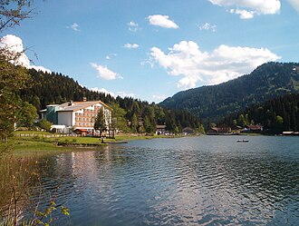
Spitzingsee is a lake in Bavaria, Germany. At an elevation of 1084 m, its surface area is 28.3 hectares (70 acres).
Geography
The Spitzingsee is located about five kilometers south of the Schliersee and a few hundred meters south of the Spitzingsattels at an altitude of 1084 m in the Schliersee Mountains in the Bavarian Alps. With a surface area of 28.3 ha (0.283 km2), it is one of the largest mountain lakes in Bavaria. The lake's maximum depth is 16.3 m (53 ft) in the south basin, while the north basin's depth is up to 10.4 m (34 ft). The Spitzingsee has a comparatively large water catchment area of 7.51 km2 (2.90 sq mi).
The lake is owned by the Free State of Bavaria; the Bavarian Administration of State-Owned Palaces, Gardens and Lakes is responsible for its administration.1 .