Slonta
اسلنطة Suluntah | |
|---|---|
Town | |
 | |
Slonta Location in Libya | |
| Coordinates: 32°35′25″N 21°42′57″E / 32.59028°N 21.71583°E / 32.59028; 21.71583 | |
| Country | |
| Region | Cyrenaica |
| District | Jabal al Akhdar |
| Population (2006)1 | |
• Total | 2,674 |
| Time zone | UTC +2 |
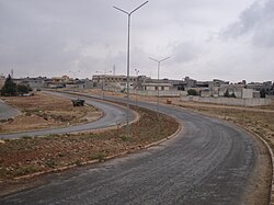
Slonta or Suluntah (Arabic: اسلنطة) is a town in the District of Jabal al Akhdar about 27 kilometres (17 mi) south of the city of Bayda.2 It is noted for its ruins of a pre-Greek temple for the Berber people,2 that used to be in a cave which has since collapsed.3
References
References
- Amraja M. el Khajkhaj, "Noumou al Mudon as Sagheera fi Libia", Dar as Saqia, Benghazi-2008, p. 120.
- Ham, Anthony (2007) "Slonta" Libya (second edition) Lonely Planet, Footscray, Victoria, Australia, page 140, ISBN 978-1-74059-493-6
- Gregory, Joel W (1916) "Cyrenaica" The Geographical Journal 47:(5) pp. 321–342, pages 332–333
External links
External links
- "Slonta" at Livius:Articles on Ancient History
- "Slonta Map — Satellite Images of Slonta" Maplandia World Gazetteer