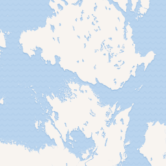
The Simpson Strait (68°32′N 097°30′W / 68.533°N 97.500°W / 68.533; -97.500 (Simpson Strait)) is a natural, shallow waterway separating King William Island to the north from Adelaide Peninsula on Nunavut's mainland to the south. The strait, an arm of the Arctic Ocean, connects the Queen Maud Gulf with Rasmussen Basin's Rae Strait.1
Simpson Strait measures 40 mi (64 km) long and 2–10 mi (3.2–16.1 km) wide,1 and there are several small islands within it: Albert, Beaver, Boulder, Castor, Chens, Club, Comb, Denille, Dolphin, Eta, Hook, Kilwinning, Pollux, Ristvedt, Saatuq, Sarvaq and Taupe.2
History
The English naval officer George Back reached Simpson Strait in 1834, but did not name it.3
In 1836, the Hudson's Bay Company wanted to "endeavour to complete the discovery and survey of the northern shores of the American continent" and so it sent the Scottish explorer Thomas Simpson and the Canadian explorer Peter Warren Dease on an expedition. Simpson and Dease reached the Simpson Strait in 1839, and named it in honor of Simpson.3
Roald Amundsen traversed it in 1903 during his first successful Northwest Passage voyage.34
References
References
- "Simpson Strait". The Columbia Gazetteer of North America. 2000. Retrieved 2008-06-02.
- "Group Name: Nunavut (Kitikmeot Region) East Centre group". rsgbiota.org. 2007-06-30. Retrieved 2008-06-02.
- Greely, A. W. (March 2007). Handbook of Polar Discoveries. ISBN 978-1-4067-6645-5.
- "Northwest Passage via Simpson Strait". quarkexpeditions.com. Archived from the original on 2008-03-17. Retrieved 2008-06-02.