Senthamangalam
சேந்தமங்கலம் | |
|---|---|
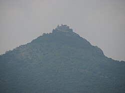 Nainamalai | |
| Nickname: | |
Senthamangalam Location in Namakkal, Tamil Nadu, India | |
| Coordinates: 11°18′00″N 78°14′00″E / 11.3000°N 78.2333°E / 11.3000; 78.2333 | |
| Country |  India India |
| State | Tamil Nadu |
| Region | Kongu Nadu |
| District | Namakkal |
| Taluk | Senthamangalam |
| Government | |
| • Type | Municipality |
| • Body | Senthamangalam Municipality |
| Elevation | 240 m (790 ft) |
| Population (2011) | |
• Total | 19,750 |
| Languages | |
| • Official | Tamil |
| Time zone | UTC+5:30 (IST) |
| PIN | 637409 |
| Telephone code | 91-4286 |
| Vehicle registration | TN-88, Namakkal South |
Sendamangalam (also transliterated as Senthamangalam) is a Municipality 1 and taluk in Namakkal district in the Indian state of Tamil Nadu.
Geography
Sendamangalam is located at 11°18′N 78°14′E / 11.30°N 78.23°E / 11.30; 78.23.2 It has an average elevation of 240 metres (790 ft). Sendamangalam is close to Kolli Hills (கொல்லி மலை), which is part of the Eastern Ghats. The closest river is the Kaveri river. The municipality is approximately 350 kilometres (220 mi) southwest of Chennai, 255 kilometres (158 mi) south of Bangalore, 50 kilometres (31 mi) south of Salem, 93 kilometres (58 mi) northwest of Tiruchirapalli, and approximately 200 kilometres (120 mi) north of Madurai.
Climate
The temperature ranges from 20 °C (68 °F) to 44 °C (111 °F) throughout the year.
Demographics
Population
As of the 2011 Indian census,3 there were 19,750 people. Males made up 49% of the population, and 51% were female. 9% of the population was under 6 years of age. The average literacy rate was 75.47%, above the national average of 59.5%. The census reported 83.9% of males were literate, while 67.5% of females were literate.
Government and politics
The Senthamangalam taluk is part of Namakkal Lok Sabha constituency, while it has its own legislative assembly constituency.4
Civic Administration
Sendamangalam began functioning as a taluk on 2 June 2015. It had previously been in Namakkal taluk.5
Transport
By Air
The nearest airports are Salem Domestic Airport and Tiruchirappalli International Airport.
By Rail
The nearest major railway stations are in Namakkal and Salem.
By Road
Sendamangalam is located 12 kilometres (7.5 mi) northeast from Namakkal on State Highway SH-95.
References
References
- uxdt. "Directorate of Town Panchayats, Tamil Nadu பேரூராட்சிகள் இயக்ககம், தமிழ்நாடு". dtp.tn.gov.in. Archived from the original on 24 January 2026. Retrieved 11 June 2026.
- Falling Rain Genomics, Inc - Sendamangalam
- "Senthamangalam Town Panchayat City Population Census 2011-2026 | Tamil Nadu". www.census2011.co.in. Retrieved 11 June 2026.
- "List of Parliamentary and Assembly Constituencies" (PDF). Tamil Nadu. Election Commission of India. Archived from the original (PDF) on 4 May 2006. Retrieved 9 October 2008.
- "New Taluks begin to function". The Hindu. 3 June 2015. Retrieved 13 December 2018.
External links
External links
- Sendamangalam Town Panchayat: Tamil Nadu Government Directorate of Panchayats
- Sendamangalam Block Panchayat Villages
- Namakkal District Webpage (Official Website of Namakkal District Government) Archived 26 September 2011 at the Wayback Machine
- Namakkal District Water Supply Status (Tamil Nadu Water Supply and Drainage Board)