Sarnakunk
Սառնակունք | |
|---|---|
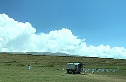 Scenery around Sarnakunk | |
Sarnakunk Sarnakunk | |
| Coordinates: 39°38′53″N 45°53′06″E / 39.64806°N 45.88500°E / 39.64806; 45.88500 | |
| Country | |
| Province | Syunik |
| Municipality | Sisian |
| Area | |
• Total | 41.72 km2 (16.11 sq mi) |
| Elevation | 2,122 m (6,962 ft) |
| Population | |
• Total | 474 |
| • Density | 11.4/km2 (29.4/sq mi) |
| Time zone | UTC+4 (AMT) |
Sarnakunk (Armenian: Սառնակունք) is a village in the Sisian Municipality of the Syunik Province in Armenia.
Toponymy
The village was previously known as Saybalu.
Demographics
The Statistical Committee of Armenia reported its population was 303 in 2022,3 down from 519 at the 2010 census.4
References
References
- "Syunik regional e-Governance System" (in Armenian). Syunik Province provincial government. Click on link entitled "Համայնքներ" (community) and search for the place by Armenian name.
- Statistical Committee of Armenia. "The results of the 2011 Population Census of Armenia" (PDF).
- "Wayback Machine" (PDF). armstat.am. Archived from the original (PDF) on 2024-06-02. Retrieved 2025-12-12.
{{cite web}}: Cite uses generic title (help) - "Marzes of Armenia and Yerevan City in Figures, 2010" (PDF). Statistical Committee of Armenia.