Ruiselede
| |
|---|---|
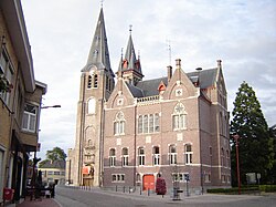 Village centre, with town hall and church of Our Lady | |
 Flag  Coat of arms | |
 Location of Ruiselede in West Flanders | |
 Interactive map of Ruiselede | |
Ruiselede Location in Belgium | |
| Coordinates: 51°02′N 03°23′E / 51.033°N 3.383°E / 51.033; 3.383 | |
| Country | Belgium |
| Community | Flemish Community |
| Region | Flemish Region |
| Province | West Flanders |
| Arrondissement | Tielt |
| Government | |
| • Mayor | Greet De Roo (RKD) |
| • Governing party | RKD |
| Population (2018-01-01)1 | |
• Total | 5,387 |
| Postal codes | 8755 |
| NIS code | 37012 |
| Area codes | 051 |
| Website | www.ruiselede.be |
Ruiselede (Dutch pronunciation: [ˈrœysəˌleːdə]; West Flemish: Ruuslee; historically Ruysselede) is a former municipality located in the Belgian province of West Flanders. This town only comprises the town of Ruiselede proper. On January 1, 2006, Ruiselede had a total population of 5,113. The total area is 30.20 km2 which gives a population density of 169 inhabitants per km2.
Ruiselede was the location of a coastal radio site. From 1923 to 1940 it had a VLF aerial. On 30 December 1933, the mast was demolished when an aircraft collided with it.
Gallery
-
![Onze-Lieve-Vrouw-ten-Hemelopnemingskerk (Ruiselede) [nl]](/api/ext/img?url=https%3A%2F%2Fupload.wikimedia.org%2Fwikipedia%2Fcommons%2Fthumb%2F3%2F3c%2FOnze-Lieve-Vlouv-ten-Hemelopnemingskerk%252C_Ruiselede_%2528DSCF0084%2529.jpg%2F60px-Onze-Lieve-Vlouv-ten-Hemelopnemingskerk%252C_Ruiselede_%2528DSCF0084%2529.jpg) Onze-Lieve-Vrouw-ten-Hemelopnemingskerk (Ruiselede)
Onze-Lieve-Vrouw-ten-Hemelopnemingskerk (Ruiselede)
References
References
- "Wettelijke Bevolking per gemeente op 1 januari 2018". Statbel. Retrieved 9 March 2019.