Roubion | |
|---|---|
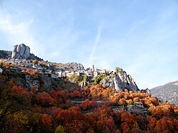 The village of Roubion in Autumn | |
 Coat of arms | |
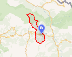 Location of Roubion | |
Roubion Roubion | |
| Coordinates: 44°05′37″N 7°03′04″E / 44.0936°N 07.0511°E / 44.0936; 07.0511 | |
| Country | France |
| Region | Provence-Alpes-Côte d'Azur |
| Department | Alpes-Maritimes |
| Arrondissement | Nice |
| Canton | Tourrette-Levens |
| Intercommunality | Métropole Nice Côte d'Azur |
| Government | |
| • Mayor (2020–2026) | Philip Bruno1 |
Area 1 | 27.26 km2 (10.53 sq mi) |
| Population (2023)2 | 112 |
| • Density | 4.11/km2 (10.6/sq mi) |
| Time zone | UTC+01:00 (CET) |
| • Summer (DST) | UTC+02:00 (CEST) |
| INSEE/Postal code | 06110 /06420 |
| Elevation | 840–2,488 m (2,756–8,163 ft) |
| 1 French Land Register data, which excludes lakes, ponds, glaciers > 1 km2 (0.386 sq mi or 247 acres) and river estuaries. | |
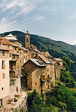
Roubion (French pronunciation: [ʁubjɔ̃]; Occitan: Robion; Italian: Robione) is a commune in the Alpes-Maritimes department in southeastern France.
Population
| Year | Pop. | ±% p.a. |
|---|---|---|
| 1968 | 102 | — |
| 1975 | 62 | −6.86% |
| 1982 | 83 | +4.26% |
| 1990 | 105 | +2.98% |
| 1999 | 113 | +0.82% |
| 2007 | 108 | −0.56% |
| 2012 | 125 | +2.97% |
| 2017 | 121 | −0.65% |
| 2023 | 112 | −1.28% |
| Source: INSEE3 | ||
References
References
- "Répertoire national des élus: les maires". data.gouv.fr, Plateforme ouverte des données publiques françaises (in French). 2 December 2020.
- "Populations de référence 2023" (in French). National Institute of Statistics and Economic Studies. 18 December 2025.
- Population municipale entre 1968 et 2023, INSEE