Rindern | |
|---|---|
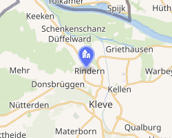 Location of Rindern | |
Rindern Rindern | |
| Coordinates: 51°48′40″N 6°7′21″E / 51.81111°N 6.12250°E / 51.81111; 6.12250 | |
| Country | Germany |
| State | North Rhine-Westphalia |
| District | Kleve |
| Town | Kleve |
| Area | |
• Total | 6.73 km2 (2.60 sq mi) |
| Population (2012-12-31) | |
• Total | 2,840 |
| • Density | 422/km2 (1,090/sq mi) |
| Time zone | UTC+01:00 (CET) |
| • Summer (DST) | UTC+02:00 (CEST) |
| Postal codes | 47533 |
Rindern is a village in the Kleve (district) of Lower Rhine region of Germany. It is part of the town Kleve.1
History
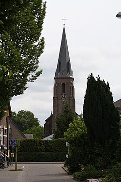
The town is mentioned, by the name Rinharos, in the 8th century, when Count Ebroin, son of Oda, made a donation to its church.2
References
References
- Rindern Archived 2021-06-19 at the Wayback Machine, Stadt Kleve
- Baron Sloet, L. A. J. W. (1872). Oorkondenboek der Graafschappen Gelre en Zutfen tot op den Slag van Woeringen, 5 Juni 1288. s'Gravenhage: Martinus Nijhoff. pp. 7 (no. 6).