Redange-sur-Attert
Réiden op der Atert | |
|---|---|
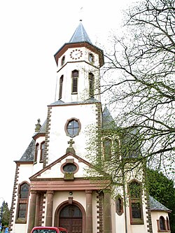 Redange church | |
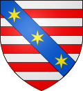 Coat of arms | |
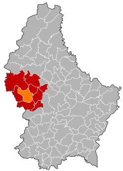 Map of Luxembourg with Redange highlighted in orange, and the canton in dark red | |
| Coordinates: 49°45′55″N 5°53′22″E / 49.765203°N 5.889355°E / 49.765203; 5.889355 | |
| Country | |
| Canton | Redange |
| Government | |
| • Mayor | Henri Gerekens |
| Area | |
• Total | 31.95 km2 (12.34 sq mi) |
| • Rank | 23rd of 100 |
| Highest elevation | 493 m (1,617 ft) |
| • Rank | 21st of 100 |
| Lowest elevation | 253 m (830 ft) |
| • Rank | 56th of 100 |
| Population (2025) | |
• Total | 2,855 |
| • Rank | 56th of 100 |
| • Density | 89.36/km2 (231.4/sq mi) |
| • Rank | 58th of 100 |
| Time zone | UTC+1 (CET) |
| • Summer (DST) | UTC+2 (CEST) |
| LAU 2 | LU0000706 |
| Website | redange.lu |
Redange or Redange-sur-Attert (French: [ʁedɑ̃ʒ]; Luxembourgish: Réiden [ˈʀɜɪ̯dən]; German: Redingen [ˈʁeːdɪŋən]) is a commune and town in northwestern Luxembourg, near the border with Belgium. It is situated in the eponymous canton of Redange. Redange is situated on the river Attert, a tributary of the Alzette.
As of 2025, the town of Redange, which lies in the west of the commune, has a population of 1,643. Other towns within the commune include Lannen, Nagem, Niederpallen, Ospern, and Reichlange.
Notable people
- Léopold Bian (1832-1899), Member of the Chamber of Deputies, Mayor of Redange, died in Redange
- Émile Bian (1873-1918), Member of the Chamber of Deputies, 1916-1918
- brothers Pierre (1913–1963) & Mathias Clemens (1915—2001), professional road bicycle racers
- Camille Kerger (born 1957), a Luxembourgish composer, opera singer and music teacher.
- Jean-Claude Juncker (born 1954), a Luxembourgish politician, Prime minister of Luxembourg (1995-2013) and President of the European Commission (2014-2019)
Population
Historical population | ||||||||||||||||||||||||||||||||||||||||||||||||||||||||||||||
|
|
| ||||||||||||||||||||||||||||||||||||||||||||||||||||||||||||
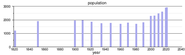 | ||||||||||||||||||||||||||||||||||||||||||||||||||||||||||||||
| Source: 1 Source data | ||||||||||||||||||||||||||||||||||||||||||||||||||||||||||||||
References
References
- "Population par canton et commune". statistiques.public.lu. Retrieved 11 January 2022.