| Rae River | |
|---|---|
 | |
| Location | |
| Country | Canada |
| Territory | Nunavut |
| Physical characteristics | |
| Source | |
| • location | Akuliakattak Lake |
| Mouth | |
• location | Coronation Gulf |
• coordinates | 67°55′01″N 115°33′00″W / 67.917°N 115.550°W / 67.917; -115.550 (Rae River) |
• elevation | Sea level |
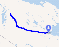
The Rae River (Pallirk) is a waterway that flows from Akuliakattak Lake1 into Richardson Bay, Coronation Gulf. Its mouth is situated northwest of Kugluktuk, Nunavut. Its shores were the ancestral home of Copper Inuit subgroups: the Kanianermiut2 (also known as Uallirgmiut) (located at the river's headwaters) and the Pallirmiut3 (located at the river's mouth).
The Rae River is named in honour of Scottish Arctic explorer John Rae.4
References
References
- Stefansson, V. (1914-12-30). "Prehistoric and Present Commerce among the Arctic Coast Eskimo". Geological Survey Museum Bulletin. 6: 14.
- "The Stefansson-Anderson Arctic Expedition of the American Museum: Preliminary Ethnological Report". Anthropological Papers of the American Museum of Natural History. 14. New York: American Museum of Natural History: 26. 1919. ISSN 0065-9452. OCLC 1116815.
- Stefansson, Vilhjalmur (1914). The Stefánsson-Anderson Arctic Expedition of the American Museum: Preliminary Ethnological Report. New York: The Trustees of the American Museum. p. 27. OCLC 13626409.
- "Dr. John Rae". Manitoba Pageant, September 1958, Volume 4, Number 1. mhs.mb.ca. Retrieved 2008-08-25.