Havelsee | |
|---|---|
 Coat of arms | |
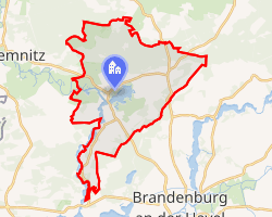
Location of Havelsee
within Potsdam-Mittelmark district | |
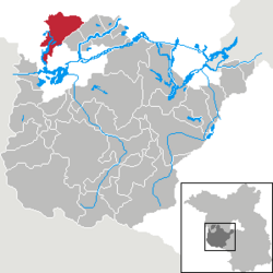
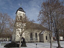
 Location of Havelsee | |
Havelsee Havelsee | |
| Coordinates: 52°30′N 12°28′E / 52.500°N 12.467°E / 52.500; 12.467 | |
| Country | Germany |
| State | Brandenburg |
| District | Potsdam-Mittelmark |
| Municipal assoc. | Beetzsee |
| Subdivisions | 8 Ortsteile |
| Government | |
| • Mayor (2024–29) | Günter Noack1 (Ind.) |
| Area | |
• Total | 81.97 km2 (31.65 sq mi) |
| Elevation | 39 m (128 ft) |
| Population (2024-12-31)2 | |
• Total | 3,181 |
| • Density | 38.81/km2 (100.5/sq mi) |
| Time zone | UTC+01:00 (CET) |
| • Summer (DST) | UTC+02:00 (CEST) |
| Postal codes | 14778, 14798 |
| Dialling codes | 033834 |
| Vehicle registration | PM |
| Website | www.havelsee.de |
Havelsee (German pronunciation: [ˈhaːfl̩ˌzeː] ⓘ) is a town in the Potsdam-Mittelmark district, in Brandenburg, Germany. It is situated on the river Havel, 12 km northwest of Brandenburg.
The Pritzerbe Ferry, a vehicular cable ferry, crosses the Havel between Havelsee and Kützkow.
Mayor
The mayor of Havelsee since 2003 is Günther Noack, he was reelected in 2014 with 83,4 % of the votes.3
Protected areas
Over 80% of the area of the borough of Havelsee is covered by overlapping protected areas of various types. These include the natural monument of Weißes Fenn Marzahne as well as 3 nature reserves and 4 SACs.
Notable people
- Lothar Kreyssig (1898-1986), magistrate in Brandenburg an der Havel, a member of the Confessing Church, euthanasia opponents and founder of Action Reconciliation Service for Peace, 1937-1971 residing in the Bruderhof at Hohenferchesar
- Walter Kuntze (1883-1960), General of the Wehrmacht
Demography

Havelsee: Population development within the current boundaries (2013)4 | |||||||||||||||||||||||||||||||||||||||||||||||||||||||||||||||||||||||||||||||||||||||||||||||||||||||||||||||||||||||||||||||
|
| ||||||||||||||||||||||||||||||||||||||||||||||||||||||||||||||||||||||||||||||||||||||||||||||||||||||||||||||||||||||||||||||
References
References
- Landkreis Potsdam-Mittelmark Wahl der Bürgermeisterin / des Bürgermeisters. Retrieved 10 July 2024.
- "Bevölkerungsstand im Land Brandenburg Dezember 2024 (Fortgeschriebene amtliche Einwohnerzahlen, basierend auf dem Zensus 2023)" (XLS). Amt für Statistik Berlin-Brandenburg (in German).
- "Bekanntmachung des endgültigen Wahlergebnisses sowie der Name des gewählten Bewerbers zur Wahl des Bürgermeisters der Stadt Havelsee am 25.05.2014" (PDF) (in German). Mühlenberg, Wahlleiterin. 3 June 2014.
- Detailed data sources are to be found in the Wikimedia Commons.Population Projection Brandenburg at Wikimedia Commons