Pignia | |
|---|---|
 Flag  Coat of arms | |
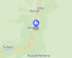 Location of Pignia | |
Pignia Pignia | |
| Coordinates: 46°36′N 9°26′E / 46.600°N 9.433°E / 46.600; 9.433 | |
| Country | Switzerland |
| Canton | Graubünden |
| District | Hinterrhein |
| Area | |
• Total | 13.41 km2 (5.18 sq mi) |
| Elevation | 1,049 m (3,442 ft) |
| Population (2005) | |
• Total | 118 |
| • Density | 8.80/km2 (22.8/sq mi) |
| Time zone | UTC+01:00 (CET) |
| • Summer (DST) | UTC+02:00 (CEST) |
| Postal code | 7443 |
| SFOS number | 3710 |
| ISO 3166 code | CH-GR |
| Surrounded by | Andeer, Ferrera, Clugin, Donat, Salouf, Zillis-Reischen |
| Website | www.pignia.ch |
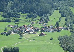
Pignia is former a municipality in the district of Hinterrhein in the Swiss canton of Graubünden. On 1 January 2009, it was annexed by Andeer.
The municipality was predominantly German-speaking, with a sizable Romansh-speaking minority.
References
References
External links
External links
- Official Web site
- Media related to Pignia at Wikimedia Commons
- "Pignia" in German, French and Italian in the online Historical Dictionary of Switzerland.