Paser Regency
Kabupaten Paser | |
|---|---|
 Nurul Falah Grand Mosque | |
 Coat of arms | |
| Motto(s): Daya Taka (Paser) "The determination of the community will continue to fight with enthusiasm, sincerity and piety to work with their own abilities" | |
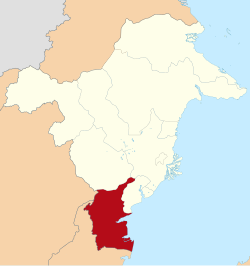 Location within East Kalimantan | |
Paser Regency Paser Regency (Indonesia) Show map of Indonesia | |
| Coordinates: 1°26′6.61″S 116°14′7.26″E / 1.4351694°S 116.2353500°E / -1.4351694; 116.2353500 | |
| Country | Indonesia |
| Province | East Kalimantan |
| Capital | Tana Paser |
| Government | |
| • Regent | Fahmi Fadli |
| • Vice Regent | Ikhwan Antasari |
| Area | |
• Total | 11,603.94 km2 (4,480.31 sq mi) |
| Elevation | 0 m (0 ft) |
| Population (mid 2025 estimate 1) | |
• Total | 315,033 |
| • Density | 27.1488/km2 (70.3151/sq mi) |
| Time zone | UTC+8 (ICST) |
| Area code | (+62) 543 |
| Website | paserkab.go.id |
Paser Regency (Indonesian: Kabupaten Paser; pronounced [kabuˌpat̪ɛn ˈpasɛr]) is the southernmost regency in the East Kalimantan province of Indonesia. It was created on 26 June 1959 from the northern parts of Kotabaru Regency. It was previously known as Pasir Regency until its renaming on 22 August 2007.2 Its northeastern districts were split off on 10 April 2002 to form the new Penajam North Paser Regency. The residual regency covers an area of 11,603.94 km2, and it had a population of 230,316 at the 2010 Census3 and 275,452 at the 2020 Census;4 the official estimate as at mid 2025 was 315,033 (comprising 49.134% males and 50.866% females).1 Its administrative centre is the town of Tana Paser (or Tanah Grogot).
History


On 26 June 1959, Pasir was first established as a regency in East Kalimantan, after being separated from Kotabaru in South Kalimantan, for "historic and social-economic reasons". At the time of its formation, it originally consisted of four districts as mentioned: Central Pasir, North Pasir (not to be confused with Penajam North Paser), Pasir Hulu, and South Pasir.5 Meanwhile, it largely inherited the borders from Onderafdeeling Pasir, with the exception of parts south of modern East Kalimantan–South Kalimantan border (still part of Kotabaru till this day). Little are known the archives relating to its separation from South Kalimantan.6
Twenty-eight years later, on 13 October 1987, Pasir annexed the district of Penajam, then known as Balikpapan Seberang.7 Four northeastern districts, namely Penajam, Sepaku (created in 1996), Waru, and Babulu (also created in 1996), were later separated on 10 April 2002 to form Penajam North Paser.8 On 22 August 2007, Pasir was officially renamed to Paser by the regional government.2
Boundaries
- North : West Kutai Regency and Penajam North Paser Regency
- East : Makassar Strait
- South : Kota Baru Regency
- West : Balangan Regency, Tabalong Regency, and North Barito Regency
Administrative districts
Following the separation of the districts in the northeast to form the new Penajam North Paser Regency on 10 April 2002, the residual Paser Regency is now divided into ten districts (kecamatan), tabulated below with their areas and their populations at the 2010 Census3 and the 2020 Census,4 together with the official estimates as of mid 2025.1 The table also includes the locations of the district administrative centres, the number of administrative villages in each district (totalling 5 urban kelurahan and 139 rural desa), and its postal codes.
Proposals have been under consideration for the existing regency to be split in two, with separate regencies being formed for South Paser and for Central Paser. The proposed South Paser Regency (Indonesian: Kabupaten Paser Selatan)9 would comprise five districts in the south and west (specifically Batu Sopang, Muara Komam, Muara Samu, Batu Engau and Tanjung Harapan) with its capital at Batu Sopang, a combined area of 5,941.34 km2 and a population of 86,886 as at mid 2025. The proposed Central Paser Regency (Indonesian: Kabupaten Paser Tengah)10 would comprise five districts in the centre and east (specifically Long Kali, Long Ikis, Kuaro, Tanah Grogot and Pasir Belonglong) with its capital at Kuaro, a combined area of 5,662.60 km2 and a population of 228,147 as at mid 2025.
| Kode Wilayah |
Name of District (kecamatan) |
Area in km2 |
Pop'n Census 2010 |
Pop'n Census 2020 |
Pop'n Estimate mid 2025 |
Admin centre |
No. of villages |
Post code |
|---|---|---|---|---|---|---|---|---|
| 64.01.01 | Batu Sopang 11 | 1,111.38 | 22,540 | 26,867 | 30,817 | Batu Kajang | 9 | 76252 |
| 64.01.10 | Muara Samu 12 | 855.25 | 4,221 | 6,855 | 8,242 | Muser | 9 | 76250 |
| 64.01.09 | Batu Engau 13 | 1,507.26 | 11,662 | 16,969 | 22,123 | Kerang | 13 | 76261 |
| 64.01.02 | Tanjung Harapan (a) 14 | 714.05 | 7,720 | 8,856 | 10,946 | Tanjung Aru | 7 | 76260 |
| 64.01.03 | Paser Belengkong 15 | 990.11 | 23,543 | 28,595 | 32,298 | Pasir Belengkong | 15 | 76271 |
| 64.01.04 | Tanah Grogot (b) 16 | 335.58 | 63,311 | 76,344 | 88,841 | Tanah Grogot | (c) 17 | 76251 |
| 64.01.05 | Kuaro17 | 747.30 | 23,934 | 29,188 | 32,572 | Kuaro | (c) 14 | 76281 |
| 64.01.06 | Long Ikis (d) 18 | 1,204.22 | 36,701 | 41,147 | 44,993 | Long Ikis | (c) 27 | 76282 |
| 64.01.07 | Muara Komam19 | 1,753.40 | 12,459 | 13,056 | 14,758 | Muara Koman | (c) 14 | 76253 |
| 64.01.08 | Long Kali 20 | 2,385.39 | 24,225 | 27,575 | 29,443 | Long Kali | (c) 24 | 76283 |
| Totals | 11,603.94 | 230,316 | 275,452 | 315,033 | Tanah Grogot | 144 |
Note: (a) including the offshore islands of Pulau Batukapal, Pulau Burung and Pulau Merayap.
(b) including the offshore islands of Pulau Rantau Besar and Pulau Rantau Kecil ("Great and Little Rantau Islands").
(c) includes one urban kelurahan - the district admin centre (the rest being desa). (d) including the offshore island of Pulau Bansik.
Climate
Tana Paser has a tropical rainforest climate (Af) with moderate rainfall in August and September and heavy to very heavy rainfall in the remaining months.
| Climate data for Tana Paser | |||||||||||||
|---|---|---|---|---|---|---|---|---|---|---|---|---|---|
| Month | Jan | Feb | Mar | Apr | May | Jun | Jul | Aug | Sep | Oct | Nov | Dec | Year |
| Mean daily maximum °C (°F) | 29.6 (85.3) |
30.1 (86.2) |
30.2 (86.4) |
30.3 (86.5) |
30.2 (86.4) |
29.8 (85.6) |
29.4 (84.9) |
30.0 (86.0) |
30.3 (86.5) |
30.7 (87.3) |
30.2 (86.4) |
29.8 (85.6) |
30.1 (86.1) |
| Daily mean °C (°F) | 26.2 (79.2) |
26.5 (79.7) |
26.5 (79.7) |
26.7 (80.1) |
26.7 (80.1) |
26.4 (79.5) |
25.9 (78.6) |
26.3 (79.3) |
26.6 (79.9) |
26.9 (80.4) |
26.5 (79.7) |
26.3 (79.3) |
26.5 (79.6) |
| Mean daily minimum °C (°F) | 22.8 (73.0) |
22.9 (73.2) |
22.9 (73.2) |
23.1 (73.6) |
23.3 (73.9) |
23.0 (73.4) |
22.5 (72.5) |
22.7 (72.9) |
22.9 (73.2) |
23.1 (73.6) |
22.9 (73.2) |
22.9 (73.2) |
22.9 (73.2) |
| Average rainfall mm (inches) | 307 (12.1) |
258 (10.2) |
358 (14.1) |
322 (12.7) |
213 (8.4) |
210 (8.3) |
201 (7.9) |
117 (4.6) |
118 (4.6) |
129 (5.1) |
210 (8.3) |
303 (11.9) |
2,746 (108.2) |
| Source: Climate-Data.org21 | |||||||||||||
References
References
- Badan Pusat Statistik, Jakarta, 27 February 2026, Kabupaten Paser Dalam Angka 2026 (Katalog-BPS 1102001.6401)
- "PP No. 49 Tahun 2007". peraturan.bpk.go.id. Retrieved 2025-01-22.
- Biro Pusat Statistik, Jakarta, 2011.
- Badan Pusat Statistik, Jakarta, 2021.
- "UU No. 27 Tahun 1959". peraturan.bpk.go.id. Retrieved 2024-12-30.
- "Arsip tentang Pisahnya Paser dengan Kalsel Masih Minim". kaltimfaktual.co. Retrieved 2025-12-28.
- "PP No. 21 Tahun 1987". peraturan.bpk.go.id. Retrieved 2024-08-23.
- "UU No. 7 Tahun 2002". peraturan.bpk.go.id. Retrieved 2024-08-25.
- Apriyanto (2022-05-21). "Jalan Panjang Perjuangan Usulan DOB Kabupaten Paser Selatan". Liputan 6. Archived from the original on 2023-05-27. Retrieved 2023-05-24.
- Sulistyowati, Hikmah (2018). "PERSEPSI MASYARAKAT KABUPATEN PASER TERHADAP WACANA PEMEKARAN KABUPATEN PASER TENGAH DARI KABUPATEN PASER". eJournal Ilmu Pemerintahan. 6 (4). FISIP Universitas Mulawarman. Archived from the original on 2023-06-07. Retrieved 2023-06-07.
- Badan Pusat Statistik, Jakarta, 26 September 2024, Kecamatan Batu Sopang Dalam Angka 2024 (Katalog-BPS 1102001.6401010)
- Badan Pusat Statistik, Jakarta, 26 September 2024, Kecamatan Muara Samu Dalam Angka 2024 (Katalog-BPS 1102001.6401011)
- Badan Pusat Statistik, Jakarta, 26 September 2024, Kecamatan Batu Engau Dalam Angka 2024 (Katalog-BPS 1102001.6401021)
- Badan Pusat Statistik, Jakarta, 26 September 2024, Kecamatan Tanjung Harapan Dalam Angka 2024 (Katalog-BPS 1102001.6401022)
- Badan Pusat Statistik, Jakarta, 26 September 2024, Kecamatan Paser Belengkong Dalam Angka 2024 (Katalog-BPS 1102001.6401030)
- Badan Pusat Statistik, Jakarta, 26 September 2024, Kecamatan Tanah Grogot Dalam Angka 2024 (Katalog-BPS 1102001.6401040)
- Badan Pusat Statistik, Jakarta, 26 September 2024, Kecamatan Kuaro Dalam Angka 2024 (Katalog-BPS 1102001.6401050)
- Badan Pusat Statistik, Jakarta, 26 September 2024, Kecamatan Long Ikis Dalam Angka 2024 (Katalog-BPS 1102001.6401060)
- Badan Pusat Statistik, Jakarta, 26 September 2024, Kecamatan Muara Komam Dalam Angka 2024 (Katalog-BPS 1102001.6401070)
- Badan Pusat Statistik, Jakarta, 26 September 2024, Kecamatan Long Kali Dalam Angka 2024 (Katalog-BPS 1102001.6401080)
- "Climate: Tana Paser". Climate-Data.org. Retrieved 24 November 2020.