Ottarsbu Ottersbo | |
|---|---|
Village | |
 Interactive map of Ottarsbu Ottersbo | |
Ottersbo Ottersbo | |
| Coordinates: 63°42′57″N 9°46′16″E / 63.7158°N 09.7712°E / 63.7158; 09.7712 | |
| Country | Norway |
| Region | Central Norway |
| County | Trøndelag |
| District | Fosen |
| Municipality | Ørland Municipality |
| Area | |
• Total | 0.29 km2 (0.11 sq mi) |
| Elevation | 37 m (121 ft) |
| Population (2024)1 | |
• Total | 404 |
| • Density | 1,393/km2 (3,610/sq mi) |
| Time zone | UTC+01:00 (CET) |
| • Summer (DST) | UTC+02:00 (CEST) |
| Post Code | 7140 Opphaug |
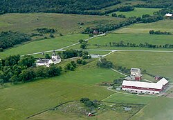
Ottersbo or Ottarsbu3 is a village in Ørland Municipality in Trøndelag county, Norway. It is located along the Stjørnfjorden, about 1 kilometre (0.62 mi) east of the Austrått manor.4
The Ottarsbu residential area was built up during the years 1977–1980. It is a peaceful quiet area with approximately 100 houses only about 8 kilometres (5.0 mi) east of the municipal center of Brekstad. The 0.29-square-kilometre (72-acre) village has a population (2024) of 404 and a population density of 1,393 inhabitants per square kilometre (3,610/sq mi).1
References
References
- Statistisk sentralbyrå (2024-10-01). "Urban settlements. Population and area, by municipality".
- "Ottarsbu, Ørland (Trøndelag)". yr.no. Retrieved 2018-02-24.
- "Informasjon om stadnamn". Norgeskart (in Norwegian). Kartverket. Retrieved 2024-11-25.
- Haugen, Morten, ed. (2017-08-20). "Ottersbo". Store norske leksikon (in Norwegian). Kunnskapsforlaget. Retrieved 2018-02-19.