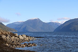
Mathieson Channel is a channel of the British Columbia Coast. It is a northern extension of Milbanke Sound.1 To its west are Pooley, Roderick, Susan and Dowager Islands, to its east the Don Peninsula. It was first charted in 1793 by James Johnstone, one of George Vancouver's lieutenants during his 1791-95 expedition.2
References
References
- "Mathieson Channel". BC Geographical Names. Government of British Columbia – B.C. Geographical Names Office (BCGNO).
- Vancouver, George, and John Vancouver (1801). A voyage of discovery to the North Pacific ocean, and round the world. London: J. Stockdale.
{{cite book}}: CS1 maint: multiple names: authors list (link)
52°38′00″N 128°11′00″W / 52.63333°N 128.18333°W / 52.63333; -128.18333