Marktleugast | |
|---|---|
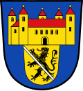 Coat of arms | |
Location of Marktleugast
within Kulmbach district | |
 Location of Marktleugast | |
Marktleugast Marktleugast | |
| Coordinates: 50°10′N 11°37′E / 50.167°N 11.617°E / 50.167; 11.617 | |
| Country | Germany |
| State | Bavaria |
| Admin. region | Oberfranken |
| District | Kulmbach |
| Municipal assoc. | Marktleugast |
| Subdivisions | 23 Ortsteile |
| Government | |
| • Mayor (2020–26) | Franz Uome1 (CSU) |
| Area | |
• Total | 33.89 km2 (13.09 sq mi) |
| Highest elevation | 627 m (2,057 ft) |
| Lowest elevation | 544 m (1,785 ft) |
| Population (2024-12-31)2 | |
• Total | 2,993 |
| • Density | 88.32/km2 (228.7/sq mi) |
| Time zone | UTC+01:00 (CET) |
| • Summer (DST) | UTC+02:00 (CEST) |
| Postal codes | 95352 |
| Dialling codes | 09255 |
| Vehicle registration | KU |
| Website | www.marktleugast.de |
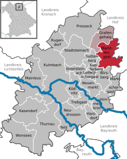
Marktleugast is a municipality in the district of Kulmbach in Bavaria in Germany.
Geography
Marktleugast is located on the southeastern edge of the Frankenwald Nature Park.
City arrangement

Marktleugast is arranged in the following boroughs:
- Baiersbach
- Filshof
- Großrehmühle
- Hanauerhof
- Hermes
- Hinterrehberg
- Hohenberg
- Hohenreuth
- Kleinrehmühle
- Kosermühle
- Mannsflur
- Marienweiher
- Marktleugast
- Mittelrehberg
- Neuensorg
- Ösel
- Roth
- Steinbach
- Tannenwirtshaus
- Traindorf
- Vorderrehberg
- Weihermühle
- Zegastmühle
References
References
- Liste der ersten Bürgermeister/Oberbürgermeister in kreisangehörigen Gemeinden, Bayerisches Landesamt für Statistik, 15 July 2021.
- "Gemeinden, Kreise und Regierungsbezirke in Bayern, Einwohnerzahlen am 31. Dezember 2024; Basis Zensus 2022" [Municipalities, counties, and administrative districts in Bavaria; Based on the 2022 Census] (CSV) (in German). Bayerisches Landesamt für Statistik.