La Cluse | |
|---|---|
Part of Dévoluy | |
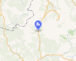 Location of La Cluse | |
La Cluse La Cluse | |
| Coordinates: 44°38′25″N 5°50′56″E / 44.6403°N 5.8489°E / 44.6403; 5.8489 | |
| Country | France |
| Region | Provence-Alpes-Côte d'Azur |
| Department | Hautes-Alpes |
| Arrondissement | Gap |
| Canton | Saint-Étienne-en-Dévoluy |
| Commune | Dévoluy |
Area 1 | 40.15 km2 (15.50 sq mi) |
| Population (2019)1 | 52 |
| • Density | 1.3/km2 (3.4/sq mi) |
| Time zone | UTC+01:00 (CET) |
| • Summer (DST) | UTC+02:00 (CEST) |
| Postal code | 05250 |
| Elevation | 1,027–2,683 m (3,369–8,802 ft) (avg. 1,252 m or 4,108 ft) |
| 1 French Land Register data, which excludes lakes, ponds, glaciers > 1 km2 (0.386 sq mi or 247 acres) and river estuaries. | |
La Cluse (French pronunciation: [la klyz]; Vivaro-Alpine: La Clusa) is a former commune in the Hautes-Alpes department in southeastern France. On 1 January 2013, Agnières-en-Dévoluy, La Cluse, Saint-Disdier, and Saint-Étienne-en-Dévoluy amalgamated into the new commune of Dévoluy.
Population
| Year | Pop. | ±% p.a. |
|---|---|---|
| 2006 | 53 | — |
| 2010 | 53 | +0.00% |
| 2019 | 52 | −0.21% |
| Source: INSEE231 | ||
References
References