Keldonk | |
|---|---|
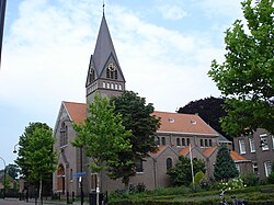 St. Anthony of Padua Church in Keldonk | |
Keldonk Location in the province of North Brabant in the Netherlands Show map of North BrabantKeldonk Keldonk (Netherlands) Show map of Netherlands | |
| Coordinates: 51°35′17″N 5°35′09″E / 51.58806°N 5.58583°E / 51.58806; 5.58583 | |
| Country | Netherlands |
| Province | North Brabant |
| Municipality | Meierijstad |
| Area | |
• Total | 6.26 km2 (2.42 sq mi) |
| Elevation | 11 m (36 ft) |
| Population (2021)1 | |
• Total | 1,030 |
| • Density | 165/km2 (426/sq mi) |
| Time zone | UTC+1 (CET) |
| • Summer (DST) | UTC+2 (CEST) |
| Postal code | 54691 |
| Dialing code | 0413 |
| Major roads | N279 |
Keldonk is a village in the south of the Netherlands. It is situated in the municipality of Meierijstad, North Brabant.
Keldonk was home to 246 people in 1840. In 1912, the St. Anthony of Padua Church was built. Until the municipal reorganization of 1994, Keldonk was located in the municipality of Erp. In 2017, it became part of Meierijstad.3
Gallery
-
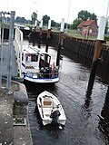 Sluice in the Zuidwillemsvaart
 -
 Draw bridge
References
References
- "Kerncijfers wijken en buurten 2021". Central Bureau of Statistics. Retrieved 17 April 2022.
two entries
- "Postcodetool for 5469AA". Actueel Hoogtebestand Nederland (in Dutch). Het Waterschapshuis. Archived from the original on 21 September 2013. Retrieved 17 April 2022.
- "Keldonk". Plaatsengids (in Dutch). Retrieved 17 April 2022.