Kelay | |
|---|---|
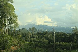 Panorama Merabu, Kelay | |
Kelay Kelay Kelay | |
| Coordinates: 1°41′36.276″N 117°4′44.3136″E / 1.69341000°N 117.078976000°E / 1.69341000; 117.078976000 | |
| Country |  Indonesia Indonesia |
| Province |  East Kalimantan East Kalimantan |
| Regency |  Berau Berau |
| District seat | Sido Bangen |
| Area | |
• Total | 6,556.54 km2 (2,531.49 sq mi) |
| Population (2020) | |
• Total | 8,958 |
| • Density | 1.366/km2 (3.539/sq mi) |
Kelay is a district (kecamatan) in Berau Regency, East Kalimantan, Indonesia.1 In the 2020 Census, it was inhabited by 8,958 people, and has a total area of 6,556.54 km2.2
Geography
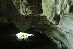
Kelay consists of 14 villages:
- Lesan Dayak
- Long Beliu
- Long Duhung
- Long Keluh
- Long Lamcin
- Long Pelay
- Long Sului
- Mapulu
- Merabu
- Merapun
- Merasa
- Muara Lesan
- Panaan
- Sido Bangen
References
References
- Kementerian Dalam Negeri Indonesia (2018-12-29). Permendagri No. 137 Tahun 2017.
- BPS, Berau, 2020-09-28, "Kecamatan Kelay Dalam Angka 2020". (Katalog: 1102001.6405010).beraukab.bps.go.id