| Jong Taia | |
|---|---|
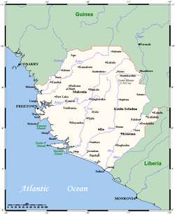 Map of Sierra Leone with Jong River. | |
| Location | |
| Country | Sierra Leone |
| Province | Eastern, Southern |
| Physical characteristics | |
| Source | |
| • location | Confluence of the Pampana River and Teye River |
| • coordinates | 8°23′27″N 11°59′50″W / 8.3907°N 11.9973°W / 8.3907; -11.9973 |
| • elevation | 63 m (207 ft) |
| Mouth | Sherbro River (Atlantic Ocean) |
• coordinates | 7°33′14″N 12°21′17″W / 7.5540°N 12.3546°W / 7.5540; -12.3546 |
• elevation | 0 m (0 ft) |
| Length | 249 km (155 mi) |
Basin size | 8,288 km2 (3,200 mi2)1 |
| Discharge | |
| • location | Near mouth |
| • average | (Period: 1971–2000) 477 m3/s (16,800 cu ft/s)1 |
| Basin features | |
| River system | Jong River |
| Tributaries | |
| • left | Bende Creek, Yaigini Creek |
The Jong or Taia river is a river flowing through Sierra Leone. It passes by the city of Mattru Jong,2 and flows into the Atlantic Ocean via some deltas.3
References
References
- "North Africa-West Coast".
- "Sierra Leone Web - Village Names".
- West Africa Topographical Maps, Series N504, 1:250,000, U.S. Army Map Service, 1955