Dzau District
ჯავის მუნიციპალიტეტი Дзауы район | |
|---|---|
District in South Ossetia | |
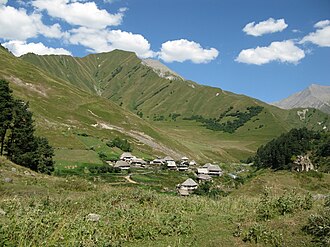 Edisa | |
 Location of Dzau District in South Ossetia | |
| Coordinates: 42°27′23.96″N 43°52′56.11″E / 42.4566556°N 43.8822528°E / 42.4566556; 43.8822528 | |
| Country | |
| De facto state | |
| Capital | Java |
| Government | |
| • Head of administration | Vladimir Kelekhsaev |
| • Votes in Parliament | (of 69) |
| Area | |
• Total | 1,448 km2 (559 sq mi) |
| Population (2015) | |
• Total | 6,567 |
| • Density | 4.535/km2 (11.75/sq mi) |
| Time zone | UTC+03:00 (MSK) |
Dzau District1 (Georgian: ჯავის მუნიციპალიტეტი, Javis municip’alit’et’i; Iron Ossetic: Дзауы район, Dzawy rajon; Russian: Дзауский район, Dzauskij rajon) is a district in South Ossetia.n 1
Geography
Roki Tunnel, Mamison Pass, Transcaucasian Highway, Ossetian Military Road and the lake Ertso are located in the district.
The largest town is Java; the second largest town is Kvaisa located in the western part of the district.
Demographics
As of 2015, the Dzau District had a population of 6,567.2
International status
According to administrative division of Georgia, Dzau District is situated in the whole territory of Java Municipality, and part of Oni Municipality and Sachkhere Municipality of Georgia.
Notes
Notes
- South Ossetia's status is disputed. It considers itself to be an independent state, but this is recognised by only a few other countries. The Georgian government and most of the world's other states consider South Ossetia de jure a part of Georgia's territory.
References
References
- Bulatov, Alexander S.; Kvashnin, Yury D.; Mamedova, Nina M. (2019-04-25). The Economy of Russia and Other Post-Soviet Countries. Cambridge Scholars Publishing. ISBN 978-1-5275-3373-8.
- "Ethnic composition of Ossetia 2015". pop-stat.mashke.org. Retrieved 2025-01-18.