Ithriya
أثريا | |
|---|---|
Village | |
Ithriya Location in Syria | |
| Coordinates: 35°22′09″N 37°47′09″E / 35.3692°N 37.7859°E / 35.3692; 37.7859 | |
| Country | |
| Governorate | Hama |
| District | Salamiyah District |
| Subdistrict | Al-Saan Nahiyah |
| Population (2004) | |
• Total | 2,118 |
| Time zone | UTC+2 (EET) |
| • Summer (DST) | UTC+3 (EEST) |
| City Qrya Pcode | C3273 |
Ithriya (Arabic: أثريا), Roman "Seriana". is a Syrian village located in Al-Saan Nahiyah in Salamiyah District, Hama. According to the Syria Central Bureau of Statistics (CBS), Ithriya had a population of 2118 in the 2004 census.1
History
In Roman times in Near Antiquity, Seriana housed a temple, known as the Church of Seriana.
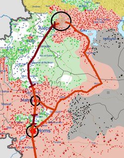
During the Syrian Civil War, Ithriyah became a strategically important point. It lays on the last highway under government control connecting the city of Aleppo to Khanasir and the Salamiyah region. In the Ithriyah-Raqqa offensive (February–March 2016) and Ithriyah-Raqqa offensive (June 2016), the town was used as a launching point for offensives against IS.
On 15 December 2022, ISIS forces ambushed a convoy of the Syrian NDF militia near the village. The ambush began following the detonation of a landmine under the militiamen's car, killing 3 NDF fighters immediately. Brief clashes took place between ISIS forces and the militiamen, another 2 NDF fighters were killed in the clashes.2
As of 5 February 2025 the village was uninhabited.3
References
References
- "General Census of Population 2004". Retrieved 2014-07-10.
- "ISIS's ambush leaves 5 members of National Defense dead in Al-Badia". hawarnews.com. 15 December 2022.
- "Syrian Arab Republic Displacement Data [IOM DTM] | Humanitarian Dataset | HDX". data.humdata.org. Retrieved 2025-05-24.