Ingeberg | |
|---|---|
Village | |
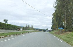 View of the road leading into the village | |
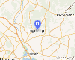 Interactive map of Ingeberg | |
Ingeberg Ingeberg | |
| Coordinates: 60°49′42″N 11°08′12″E / 60.82822°N 11.13667°E / 60.82822; 11.13667 | |
| Country | Norway |
| Region | Eastern Norway |
| County | Innlandet |
| District | Hedmarken |
| Municipality | Hamar Municipality |
| Area | |
• Total | 0.47 km2 (0.18 sq mi) |
| Elevation | 197 m (646 ft) |
| Population (2024)1 | |
• Total | 927 |
| • Density | 1,972/km2 (5,110/sq mi) |
| Time zone | UTC+01:00 (CET) |
| • Summer (DST) | UTC+02:00 (CEST) |
| Post Code | 2323 Ingeberg |
Ingeberg3 is a village in Hamar Municipality in Innlandet county, Norway. The village is located about 3.5 kilometres (2.2 mi) north of the village of Ridabu and about 5 kilometres (3.1 mi) northeast of the town of Hamar.
The 0.47-square-kilometre (120-acre) village has a population (2024) of 927 and a population density of 1,972 inhabitants per square kilometre (5,110/sq mi).1
History
The earliest existing document mentioning the village is dated 1339. This document is currently held in the state archives at Hamar.
References
References
- Statistisk sentralbyrå (1 October 2024). "Urban settlements. Population and area, by municipality".
- "Ingeberg, Hamar". yr.no. Retrieved 31 March 2022.
- "Informasjon om stadnamn". Norgeskart (in Norwegian). Kartverket. Retrieved 7 July 2025.