In general, an imaginary line is usually any sort of geometric line (more generally, curves) that has only an abstract definition and does not physically exist. They are often used to properly identify places on a map.
Some outside geography do exist. A centerline is a nautical term for a line down the center of a vessel lengthwise.
Examples
Geography
As a geographical concept, an imaginary line may serve as an arbitrary division, such as
- Antarctic Circle
- Arctic Circle
- Border
- International Date Line
- Latitude, including the Equator, the Tropic of Capricorn and the Tropic of Cancer
- Longitude, the Prime Meridian1 Any axis about which an object spins is an imaginary line.
- Mason–Dixon line, which informally marks pieces of the borders of four U.S. states: Delaware, Maryland, Pennsylvania, and West Virginia, once part of Virginia. Symbolically, the line separates the Northern United States from the Southern United States
- Missouri Compromise Line
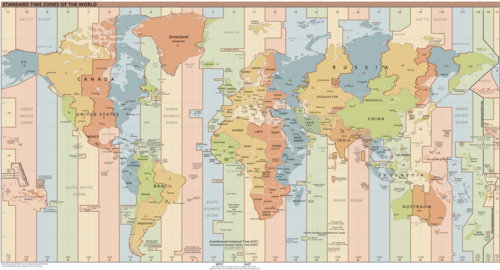
- Time zones
Science and engineering
- Line of sight
- Optical ray
- Force lines in mechanical and structural engineering
- Field lines for electric and magnetic fields
References
References
- Rosenberg, Matt (26 January 2020). "Major Lines of Latitude and Longitude on a World Map".