Ikongo
Fort Canot | |
|---|---|
 Ikongo | |
Ikongo Location in Madagascar | |
| Coordinates: 21°53′S 47°26′E / 21.883°S 47.433°E / -21.883; 47.433 | |
| Country |  Madagascar Madagascar |
| Region | Fitovinany |
| District | Ikongo |
| Elevation | 310 m (1,020 ft) |
| Population (2018)2 | |
• Total | 36,684 |
| Time zone | UTC3 (EAT) |
| Postal code | 310 |
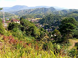
Ikongo (formerly: Fort Canot ) is a town in the region of Fitovinany eastern Madagascar. It is approximately 90 km south-east of the provincial capital Fianarantsoa. It has a population of 36,684 inhabitants.
Rivers
The town lies at the Sandrananta River.
Roads
Ikongo is situated on the unpaved National Road 14 between Ifanadiana and Vohipeno.
References
References
- Estimated based on DEM data from Shuttle Radar Topography Mission
- TROISIEME RECENSEMENT GENERAL DE LA POPULATION ET DE L’HABITATION