| Ible | |
|---|---|
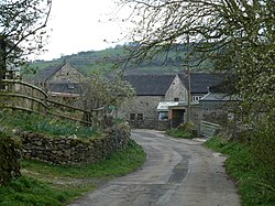 Lane through Ible | |
Ible Location within Derbyshire | |
| OS grid reference | SK248571 |
| District | |
| Shire county | |
| Region | |
| Country | England |
| Sovereign state | United Kingdom |
| Post town | MATLOCK |
| Postcode district | DE4 |
| Police | Derbyshire |
| Fire | Derbyshire |
| Ambulance | East Midlands |
Ible (pronounced 'eyebull', or 'ib-ull') is a hamlet in Derbyshire, England, just within the Peak District National Park.1
It is near the Via Gellia valley, the historic market town of Wirksworth and village of Bonsall, and is on the route of the Limestone Way12 and the Peak District Boundary Walk.3
The name of the hamlet is derived from the Old English for "Ibba's Hollow".4
References
References
- OL24 White Peak area (Map). 1:25000. Explorer. Ordnance Survey.
- "The Limestone Way Walker's Guide" (PDF). Visit Peak District. February 2007. Archived from the original (PDF) on 1 December 2020. Retrieved 16 August 2020.
- McCloy, Andrew (2017). Peak District Boundary Walk: 190 Miles Around the Edge of the National Park. Friends of the Peak District. ISBN 978-1909461536.
- English Place-Name Society database at Nottingham University
External links
External links
- GENUKI(tm) page
- Wirksworth.net, your Wirksworth Online Archived 12 December 2023 at the Wayback Machine
- grid reference SK250570