Hammersbach | |
|---|---|
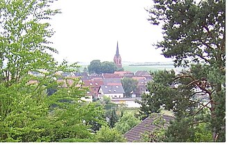 View of Hammersbach | |
 Coat of arms | |
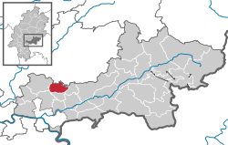
Location of Hammersbach
within Main-Kinzig-Kreis district | |
 Location of Hammersbach | |
Hammersbach Hammersbach | |
| Coordinates: 50°13′N 08°59′E / 50.217°N 8.983°E / 50.217; 8.983 | |
| Country | Germany |
| State | Hesse |
| Admin. region | Darmstadt |
| District | Main-Kinzig-Kreis |
| Subdivisions | 3 districts |
| Government | |
| • Mayor (2022–28) | Michael Göllner1 (SPD) |
| Area | |
• Total | 20.15 km2 (7.78 sq mi) |
| Highest elevation | 160 m (520 ft) |
| Lowest elevation | 135 m (443 ft) |
| Population (2024-12-31)2 | |
• Total | 4,843 |
| • Density | 240.3/km2 (622.5/sq mi) |
| Time zone | UTC+01:00 (CET) |
| • Summer (DST) | UTC+02:00 (CEST) |
| Postal codes | 63546 |
| Dialling codes | 06185 |
| Vehicle registration | MKK |
| Website | www.hammersbach.de |
Hammersbach is a municipality in the district of Main-Kinzig-Kreis, in Hesse, Germany.
Location
Hammersbach is located near Frankfurt am Main. Since 2007 Hammersbach has an official connection to the motorway A45 that has been planned for a long time. Prior to that, it was necessary to use the Raststätte Langen-Bergheim to get access the motorway.
Constituent communities
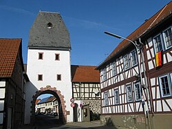
It consists of two villages: Marköbel and Langen-Bergheim. Only Marköbel once belonged to the Roman Empire. Parts of the Limes were found there recently.
Culture and sightseeing
Hammersbach has many beautiful old houses in the town center. The elementary school (Astrid-Lindgren-Schule) of Hammersbach can be seen easily from the fields around the village, because of the cone-shaped roof.
References
References
- "Ergebnisse der letzten Direktwahl aller hessischen Landkreise und Gemeinden" (XLS) (in German). Hessisches Statistisches Landesamt. 5 September 2022.
- "Bevölkerung in Hessen am 31.12.2024 (Einwohnerzahlen auf Grundlage des Zensus 2022)" (XLS) (in German). Hessisches Statistisches Landesamt.