| Guggernell | |
|---|---|
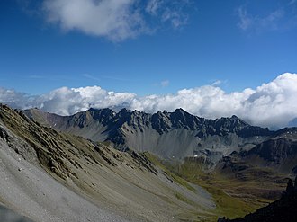 The Guggernellgrat (centre-right) and the Guggernell (right) | |
| Highest point | |
| Elevation | 2,744 m (9,003 ft) |
| Prominence | 64 m (210 ft)1 |
| Parent peak | Guggernellgrat |
| Coordinates | 46°43′20.8″N 9°39′12.4″E / 46.722444°N 9.653444°E / 46.722444; 9.653444 |
| Geography | |
Guggernell Location in Switzerland | |
| Location | Graubünden, Switzerland |
| Parent range | Plessur Range |
The Guggernell is a mountain of the Plessur Alps, located south of Arosa in the canton of Graubünden. It lies west of the Guggernellgrat.
References
References
- Retrieved from the Swisstopo topographic maps and Google Earth. The key col is located east of the summit at 2,680 metres.