Großkorbetha | |
|---|---|
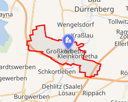 Location of Großkorbetha | |
Großkorbetha Großkorbetha | |
| Coordinates: 51°15′36″N 12°1′52″E / 51.26000°N 12.03111°E / 51.26000; 12.03111 | |
| Country | Germany |
| State | Saxony-Anhalt |
| District | Burgenlandkreis |
| Town | Weißenfels |
| Area | |
• Total | 12.68 km2 (4.90 sq mi) |
| Elevation | 108 m (354 ft) |
| Population (2009-12-31) | |
• Total | 1,923 |
| • Density | 151.7/km2 (392.8/sq mi) |
| Time zone | UTC+01:00 (CET) |
| • Summer (DST) | UTC+02:00 (CEST) |
| Postal codes | 06688 |
| Dialling codes | 034446 |
| Vehicle registration | WSF |
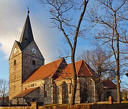
Großkorbetha is a village and a former municipality in the Burgenlandkreis district, in Saxony-Anhalt, Germany. Since 1 September 2010, it is part of the town Weißenfels.1
Historical Population
Like many urban centres in the former East Germany, the population has declined since the Reunification of Germany.
Development of population (as of December 31 from 1995 on):
| Year | Inhabitants |
|---|---|
| 1840 | 581 |
| 1931 | 1,798 |
| 1990 | 2,358 * |
| 1995 | 2,235 |
| 2000 | 2,204 |
| 2005 | 2,031 |
| 2006 | 2,008 |
| 2007 | 1,965 |
* 3 October (census)
References
References
- "Gebietsänderungen vom 01. Januar bis 31. Dezember 2010" (in German). Federal Statistical Office of Germany. Retrieved 4 November 2024.