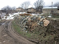
Getatagh
Գետաթաղ | |
|---|---|
 | |
Getatagh Getatagh | |
| Coordinates: 39°25′29″N 46°07′17″E / 39.42472°N 46.12139°E / 39.42472; 46.12139 | |
| Country | |
| Province | Syunik |
| Municipality | Sisian |
| Area | |
• Total | 21.76 km2 (8.40 sq mi) |
| Population | |
• Total | 182 |
| • Density | 8.36/km2 (21.7/sq mi) |
| Time zone | UTC+4 (AMT) |
Getatagh (Armenian: Գետաթաղ) is a village in the Sisian Municipality of the Syunik Province in Armenia.
Historical heritage sites
The St. Astvatsatsin Church in the village was built in 1702.3
Demographics
The Statistical Committee of Armenia reported its population as 220 in 2010,4 up from 194 at the 2001 census.5
Gallery
-
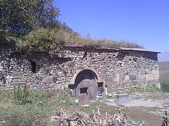 Saint Astvatsatsin Church in Getatagh
References
References
- "Syunik regional e-Governance System" (in Armenian). Syunik Province provincial government. Click on link entitled "Համայնքներ" (community) and search for the place by Armenian name.
- Statistical Committee of Armenia. "The results of the 2011 Population Census of Armenia" (PDF).
- Kiesling, Rediscovering Armenia, p. 94, available online at the US embassy to Armenia's website Archived June 26, 2008, at the Wayback Machine
- "Marzes of Armenia and Yerevan City in Figures, 2010" (PDF). Statistical Committee of Armenia.
- Report of the results of the 2001 Armenian Census, Statistical Committee of Armenia