Frano
فرانو | |
|---|---|
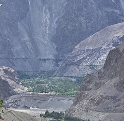 Distant view of the Frano village as seen from Thang in the Turtuk valley. | |
Frano Frano | |
| Coordinates: 34°56′04″N 76°43′47″E / 34.93448°N 76.72972°E / 34.93448; 76.72972 | |
| Country |  Pakistan Pakistan |
| State | Gilgit-Baltistan |
| District | Ghanche |
| Tehsil | Chorbat |
| Elevation | 2,699 m (8,856 ft) |
| Population | |
• Total | 400 |
| Time zone | UTC+5:00 (PST) |
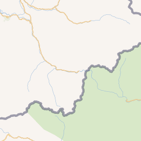
Frano or Franunote 1 (Urdu: فرانو, romanized: frāno) is border village and union council which lies in Chorbat Valley, in the Ghanche District, Gilgit-Baltistan.1 The village lies upon the banks of the Shyok River. It is considered as the last village of Pakistan, with the LOC, 2.5km away, succeeding it.2
Frano is also noted in travel media as one of the easternmost Pakistani villages in Baltistan and as a vantage point from which nearby Indian-administered villages across the Shyok valley can be seen.
History


Attractions
Frano has a notable boulder covered with ancient rock carvings. The engravings, along with inscriptions, are believed to the reminiscence of Tibetan Buddhism culture in the valley, which date back to the 13th century CE and include shapes such as circles, squares, and phallic symbols.
The Appo Ali Shah Bridge, is deemed to be the first cantilever bridge ever built in the region of Baltistan. It was built by Ali Shah, a local farmer, in 1936, with trees and local wood.1
Pak-Indo War
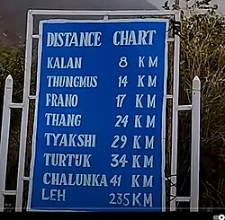
The villages of Frano in Baltistan and Thang, Ladakh were twin villages with families holding properties and homes in both sides. Following the Indo-Pakistani war of 1971, the villages were cut off from each other.3
Geography
Administratively, Frano is one of the two union councils overseing additional villages or settlements in the Shyok Valley - the other being Siksa. Settlements which come under the Frano Union Council include:
- Marcha
- Partuk
- Siari
- Thongmus
Education and Health
The village has two publicly run primary schools and a high school.4 The first school was established in 1953, followed by another primary school in 1995. In 2011, a primary school for girls was also established.5
Frano has a local dispensary, while the nearest hospital is located in Siksa.56
Notes
Notes
- The village is popularly known by "Pharnu" or "Prahnu" across the LOC, a corruption of the Urdu transliteration or pronunciation.
References
References
- "In Pakistan's north, RCC overpasses replace hanging bridges to reduce travel time, locals' woes". Arab News. 2022-10-03. Retrieved 2025-08-19.
- Bhatti, Nasr Ahmed (2022-03-30). "رٹو سے فرانو تک: موسمِ سرما میں گلگت بلتستان کی سیر". Dawn News Urdu (in Urdu). Retrieved 2025-09-28.
- Srivatsa, Sharath S. (2021-10-01). "A people who became Indian overnight". The Hindu. ISSN 0971-751X. Retrieved 2025-09-27.
{{cite news}}: CS1 maint: deprecated archival service (link) - "EMIS GB". emis.gilgitbaltistan.gov.pk. Retrieved 2025-09-27.
- "Mapping - P&DD GB". mapping.pnd.gog.pk. Retrieved 2025-09-27.
- "Water, Sanitation, Hygiene and Health" (PDF). www.ircwash.org. Archived from the original (PDF) on 2024-07-18. Retrieved 2025-09-28.