| Ferrel Seamount | |
|---|---|
 | |
| Summit depth | 2,650 m (8,694 ft) |
| Height | 2,650 m (8,694 ft)1 |
| Summit area | volume:1687km31 setting:Abyssal plain |
| Location | |
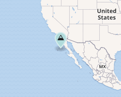
| Location | Southwest of Baja California |
| Coordinates | 29°30′52″N 117°17′39″W / 29.51444°N 117.29417°W / 29.51444; -117.294171 |
| Country | California |
| Geology | |
| Type | small A3 Seamount1 |
| Volcanic arc/chain | Hotspot volcano |
| Age of rock | plate 53-63 million years.1 |
Ferrel Seamount is a small seamount (underwater volcano) west of Baja California, at 29°30′52″N 117°17′39″W / 29.51444°N 117.29417°W / 29.51444; -117.29417. Ferrel seamount has been mapped approximately 18% by the USGS, and has two summits. It is located in the Baja California seamounts region and sits on the edge of the abyssal plain.1
References
References
- "Detailed Seamount Information - Ferrel Seamount". Seamounts Database. Retrieved 2009-03-26.