Famars | |
|---|---|
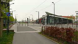 The tramway in Famars | |
 Coat of arms | |
 Location of Famars | |
Famars Famars | |
| Coordinates: 50°19′N 3°31′E / 50.31°N 3.52°E / 50.31; 3.52 | |
| Country | France |
| Region | Hauts-de-France |
| Department | Nord |
| Arrondissement | Valenciennes |
| Canton | Aulnoy-lez-Valenciennes |
| Intercommunality | CA Valenciennes Métropole |
| Government | |
| • Mayor (2020–2026) | Véronique Dupire1 |
Area 1 | 4.73 km2 (1.83 sq mi) |
| Population (2023)2 | 2,474 |
| • Density | 523/km2 (1,350/sq mi) |
| Time zone | UTC+01:00 (CET) |
| • Summer (DST) | UTC+02:00 (CEST) |
| INSEE/Postal code | 59221 /59300 |
| Elevation | 36–87 m (118–285 ft) (avg. 72 m or 236 ft) |
| 1 French Land Register data, which excludes lakes, ponds, glaciers > 1 km2 (0.386 sq mi or 247 acres) and river estuaries. | |
Famars (French pronunciation: [famaʁs] ⓘ) is a commune in the Nord department in northern France.3
Population
| Year | Pop. | ±% p.a. |
|---|---|---|
| 1968 | 1,132 | — |
| 1975 | 1,567 | +4.75% |
| 1982 | 1,444 | −1.16% |
| 1990 | 2,002 | +4.17% |
| 1999 | 2,499 | +2.49% |
| 2007 | 2,495 | −0.02% |
| 2012 | 2,475 | −0.16% |
| 2017 | 2,517 | +0.34% |
| 2023 | 2,474 | −0.29% |
| Source: INSEE4 | ||
Heraldry
|
The arms of Famars are blazoned : Sable billetty, a lion Or, armed, langued and crowned argent.
|
References
References
- "Répertoire national des élus: les maires" (in French). data.gouv.fr, Plateforme ouverte des données publiques françaises. 13 September 2022.
- "Populations de référence 2023" (in French). National Institute of Statistics and Economic Studies. 18 December 2025.
- INSEE commune file
- Population municipale entre 1968 et 2023, INSEE