Edelsfeld | |
|---|---|
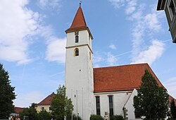 Church of Saint Stephen | |
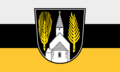 Flag  Coat of arms | |
Location of Edelsfeld
within Amberg-Sulzbach district | |
 Location of Edelsfeld | |
Edelsfeld Edelsfeld | |
| Coordinates: 49°34′N 11°42′E / 49.567°N 11.700°E / 49.567; 11.700 | |
| Country | Germany |
| State | Bavaria |
| Admin. region | Oberpfalz |
| District | Amberg-Sulzbach |
| Subdivisions | 26 Ortsteile |
| Government | |
| • Mayor (2020–26) | Hans-Jürgen Strehl1 (FW) |
| Area | |
• Total | 34.72 km2 (13.41 sq mi) |
| Elevation | 528 m (1,732 ft) |
| Population (2024-12-31)2 | |
• Total | 1,972 |
| • Density | 56.80/km2 (147.1/sq mi) |
| Time zone | UTC+01:00 (CET) |
| • Summer (DST) | UTC+02:00 (CEST) |
| Postal codes | 92265 |
| Dialling codes | 09665 |
| Vehicle registration | AS |
| Website | www |

Edelsfeld is a municipality in the district of Amberg-Sulzbach in Bavaria, Germany.
Geography
Apart from Edelsfeld the municipality consists of the following villages:3
- Alternsthof
- Bernricht
- Birkhof
- Boden
- Eberhardsbühl
- Gassenhof
- Kalchsreuth
- Kleinalbershof
- Neuernsthof
- Neumühle
- Niederärndt
- Oberndorf
- Riglashof
- Schmalnohe
- Schnellersdorf
- Sigras
- Silbergrub
- Sinnleithen
- Steinling
- Stopfmühle
- Streitbühl
- Trosthof
- Vögelas
- Wegscheid
- Weißenberg
Notable people
References
References
- Liste der ersten Bürgermeister/Oberbürgermeister in kreisangehörigen Gemeinden, Bayerisches Landesamt für Statistik, 15 July 2021.
- "Gemeinden, Kreise und Regierungsbezirke in Bayern, Einwohnerzahlen am 31. Dezember 2024; Basis Zensus 2022" [Municipalities, counties, and administrative districts in Bavaria; Based on the 2022 Census] (CSV) (in German). Bayerisches Landesamt für Statistik.
- "Ortsteile - Gemeinde Edelsfeld, Landkreis Amberg-Sulzbach - BayernPortal". Retrieved 2024-02-15.