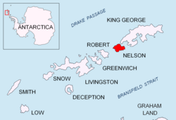
Duthoit Point (62°18′42″S 58°49′47″W / 62.31169°S 58.82964°W / -62.31169; -58.82964) is a point which forms the eastern tip of Nelson Island, in the South Shetland Islands. The point appears on charts dating back to 1822. It was recharted by Discovery Investigations, 1934–35, and named after Arthur Duthoit, a draftsman in the Admiralty Hydrographic Office at the time.1
References
References
This article incorporates public domain material from "Duthoit Point". Geographic Names Information System. United States Geological Survey.