| Duncan Ranges | |
|---|---|
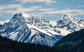 The Albert Peaks | |
| Highest point | |
| Peak | Mount Templeman |
| Elevation | 3,074 m (10,085 ft) |
| Coordinates | 50°41′23″N 117°12′18″W / 50.68972°N 117.20500°W / 50.68972; -117.205001 |
| Geography | |
Duncan Ranges Location in British Columbia | |
Country | Canada |
Province | British Columbia |
District | Kootenay Land District2 |
Range coordinates | 50°50′59″N 117°28′59″W / 50.84972°N 117.48306°W / 50.84972; -117.483062 |
| Parent range | Selkirk Mountains |
| Topo map | NTS 82K13 Camborne3 |
The Duncan Ranges are a subrange of the Selkirk Mountains of the Columbia Mountains in southeastern British Columbia, Canada, located west of the Duncan River, southeast of Revelstoke.
Notable peaks
- Albert Peak
- North Albert Peak
- Mount Cartier
- Ghost Peak
- Mount Mackenzie
- Mount Templeman
Sub-ranges
References
References
- "Mount Templeman". Geographical Names Data Base. Natural Resources Canada. Retrieved 2025-09-11.
- "Duncan Ranges". BC Geographical Names. Government of British Columbia – B.C. Geographical Names Office (BCGNO). Retrieved 2025-09-11.
- "Duncan Ranges". Geographical Names Data Base. Natural Resources Canada. Retrieved 2025-09-11.
- Duncan Ranges in the Canadian Mountain Encyclopedia