

Dulo Hill (Bulgarian: хълм Дуло, ‘Halm Dulo’ \'h&lm 'du-lo\) is a rocky hill rising to 210 m (690 ft) in Dospey Heights on Byers Peninsula of Livingston Island in the South Shetland Islands, Antarctica. It overlooks President Beaches to the south.
The feature is part of the Antarctic Specially Protected Area ASPA 126 Byers Peninsula, situated in one of its restricted zones.1
The hill is named after the Bulgarian ruling dynasty of Dulo (7th–10th century).
Location
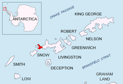
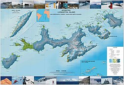
Dulo Hill is located at 62°36′05.2″S 61°09′22.5″W / 62.601444°S 61.156250°W / -62.601444; -61.156250 which is 1.2 km (0.75 mi) southeast of Start Hill, 2.52 km (1.57 mi) south of Voyteh Point and 2.49 km (1.55 mi) west-northwest of Penca Hill (British mapping in 1968, Spanish in 1992, and Bulgarian in 2005 and 2009).
Maps
- Península Byers, Isla Livingston. Mapa topográfico a escala 1:25000. Madrid: Servicio Geográfico del Ejército, 1992.
- L.L. Ivanov et al. Antarctica: Livingston Island and Greenwich Island, South Shetland Islands. Scale 1:100000 topographic map. Sofia: Antarctic Place-names Commission of Bulgaria, 2005.
- L.L. Ivanov. Antarctica: Livingston Island and Greenwich, Robert, Snow and Smith Islands. Scale 1:120000 topographic map. Troyan: Manfred Wörner Foundation, 2009. ISBN 978-954-92032-6-4
Notes
Notes
- Management Plan for Antarctic Specially Protected Area No. 126 Byers Peninsula. Measure 4 (2016), ATCM XXXIX Final Report. Santiago, 2016
References
References
- Dulo Hill. SCAR Composite Gazetteer of Antarctica.
- Bulgarian Antarctic Gazetteer. Antarctic Place-names Commission. (details in Bulgarian, basic data in English)
External links
External links
- Dulo Hill. Copernix satellite image
This article includes information from the Antarctic Place-names Commission of Bulgaria which is used with permission.