Diedorf | |
|---|---|
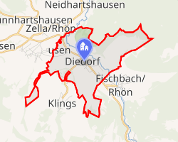 Location of Diedorf | |
Diedorf Diedorf | |
| Coordinates: 50°39′42″N 10°7′28″E / 50.66167°N 10.12444°E / 50.66167; 10.12444 | |
| Country | Germany |
| State | Thuringia |
| District | Wartburgkreis |
| Municipality | Dermbach |
| Area | |
• Total | 4.76 km2 (1.84 sq mi) |
| Elevation | 400 m (1,300 ft) |
| Population (2017-12-31) | |
• Total | 345 |
| • Density | 72.5/km2 (188/sq mi) |
| Time zone | UTC+01:00 (CET) |
| • Summer (DST) | UTC+02:00 (CEST) |
| Postal codes | 36452 |
| Dialling codes | 036966 |
| Vehicle registration | WAK |
Diedorf (German pronunciation: [ˈdiːdɔʁf]) is a village and former municipality located in the Wartburgkreis district of Thuringia, Germany. As of 1 January 2019, it has become part of the municipality Dermbach.1
The first children's stocking factory in the German Democratic Republic was in Diedorf.2 The building has been converted to a cultural center called the Alte Strumpffabrik.34
The village has a milk filling station.3
References
References
- "ParlDok". parldok.thueringer-landtag.de. Retrieved 6 August 2025.
- "Erste Kinderstrumpfhose der DDR". Göttinger Tageblatt (in German). 22 December 2015. Archived from the original on 22 December 2015.
- "Unser Dorf hat Wochenende: Diedorf". MDR (in German). 26 May 2024. Retrieved 2 August 2024.
- "Alte Strumpffabrik Bildungs- & Kulturzentrum". Alte Strumpffabrik Bildungs- & Kulturzentrum (in German). Retrieved 2 August 2024.