Daudkandi | |
|---|---|
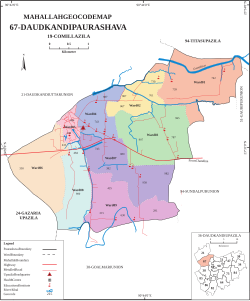
Daudkandi Map showing Daudkandi town in Bangladesh | |
| Coordinates: 23°31′46″N 90°43′46″E / 23.529484°N 90.729523°E / 23.529484; 90.729523 | |
| Country | Bangladesh |
| Division | Comilla |
| Upazila | Daudkandi |
| Urban area | 1995 |
| Government | |
| • Type | Municipality |
| • Mayor | Mizanur Rahman |
| Area | |
• Total | 16.64 km2 (6.42 sq mi) |
| Population (2011) | |
• Total | 38,317 |
| • Density | 2,303/km2 (5,964/sq mi) |
| Time zone | UTC+6 (Bangladesh Standard Time) |
Daudkandi is a town located in the Comilla district, which falls under the Chittagong Division in the southern region of Bangladesh. Administratively, the town serves as the headquarters of the Daudkandi Upazila. It is the largest urban area in Daudkandi Upazila.
Population
According to the 2011 Bangladesh Census, the total population of Daudkandi town is 46,256, of which 22,887 are male and 23,369 are female. The town has a total of 9,400 households.1
Geography
The latitude and longitude of the town are 23°31′46″N 90°43′46″E / 23.529484°N 90.729523°E / 23.529484; 90.729523. The average elevation of the town above sea level is 8.11 meters.2
References
References
- BANGLADESH POPULATION AND HOUSING CENSUS 2011 (URBAN AREA REPORT) (PDF) (Report). Bangladesh Bureau of Statistics. August 2014. Retrieved 17 October 2024.
- "Daudkandi 3516 Latitude and Longitude". distancesto.com. Retrieved 18 October 2024.