Commana
Kommanna | |
|---|---|
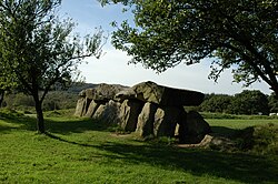 Mougau Gallery grave | |
 Coat of arms | |
 Location of Commana | |
Commana Commana | |
| Coordinates: 48°24′51″N 3°57′10″W / 48.4142°N 3.9528°W / 48.4142; -3.9528 | |
| Country | France |
| Region | Brittany |
| Department | Finistère |
| Arrondissement | Morlaix |
| Canton | Landivisiau |
| Intercommunality | Pays de Landivisiau |
| Government | |
| • Mayor (2020–2026) | Philippe Guéguen1 |
Area 1 | 39.90 km2 (15.41 sq mi) |
| Population (2023)2 | 983 |
| • Density | 24.6/km2 (63.8/sq mi) |
| Time zone | UTC+01:00 (CET) |
| • Summer (DST) | UTC+02:00 (CEST) |
| INSEE/Postal code | 29038 /29450 |
| Elevation | 104–372 m (341–1,220 ft) |
| 1 French Land Register data, which excludes lakes, ponds, glaciers > 1 km2 (0.386 sq mi or 247 acres) and river estuaries. | |
Commana (French pronunciation: [kɔmana]; Breton: Kommanna) is a commune in the Finistère department of Brittany in northwestern France.
Population
| Year | Pop. | ±% p.a. |
|---|---|---|
| 1968 | 1,370 | — |
| 1975 | 1,262 | −1.17% |
| 1982 | 1,153 | −1.28% |
| 1990 | 1,061 | −1.03% |
| 1999 | 988 | −0.79% |
| 2007 | 1,030 | +0.52% |
| 2012 | 1,108 | +1.47% |
| 2017 | 1,036 | −1.33% |
| 2023 | 983 | −0.87% |
| Source: INSEE3 | ||
Inhabitants of Commana are called in French Commanéens.
Breton language
In 2023, 39.2% of primary-school children attended bilingual schools, where Breton language is taught alongside French.4
See also
See also
References
References
- "Répertoire national des élus: les maires" (in French). data.gouv.fr, Plateforme ouverte des données publiques françaises. 13 September 2022.
- "Populations de référence 2023" (in French). National Institute of Statistics and Economic Studies. 18 December 2025.
- Population municipale entre 1968 et 2023, INSEE
- (in French) Ofis ar Brezhoneg: Enseignement bilingue Archived November 14, 2008, at the Wayback Machine
External links
External links
- Official website (in French)
- Base Mérimée: Search for heritage in the commune, Ministère français de la Culture. (in French)
- Mayors of Finistère Association (in French)